Realising mountains are quite difficult to cycle over – 3 weeks of crisscrossing the Peruvian Andes

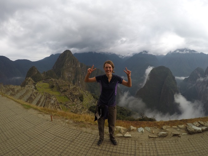
I’m writing this from the 17th floor rooftop pool of a hotel in Lima, celebrating 6 months to the day since we pushed off from Ipanema Beach in Rio de Janiero.  There’s a family from Yorkshire occupying the sun loungers next to us, and filling my ears with a gorgeous familiar drawl that makes me slightly homesick in a nice way.  I have (my 3rd) gin and tonic in my hand, and the sun is setting over the Pacific in front of us.  Life is good

The last month of crawling through the mountains and dodging snow storms now seems like a world away, but looking back at the elevation profile from my little GPS tracker brings screaming back every thigh busting high and bone shaking low of the last stage of our highland adventures.   It also makes me think back to a year ago when I had to dismount and push my bike over the biggest hill that Southern England when attempting to cycle from Brighton over Ditchling Beacon (a mighty 248 metres)!

great-divide-2

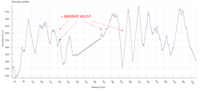
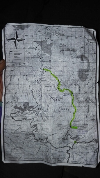
Very technical diagram which basically shows “we climbed lots of massive hills and it was really hard!”

With the exception of our jungle detour, we’ve been above 3000m now for well over 3 months, and it was all leading up to this part of our trip – the real Peruvian Andes. The Cordilleras. No more foothills, no more flat stretches, just one gravelly mountain pass after another that took us a thousand slow kilometersfrom from Ayacucho to Huaraz, where we spent another couple of weeks in our hiking boots .  There were daily 1000m+ climbs, descents that sent me flying off my bike, beautiful wilderness and wild camping spots that made us feel like we were the only people for miles around. It was gorgeous, and it was fricking hard. So I think I will pour a 4th G&T whilst I remnisce….

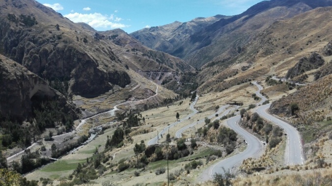
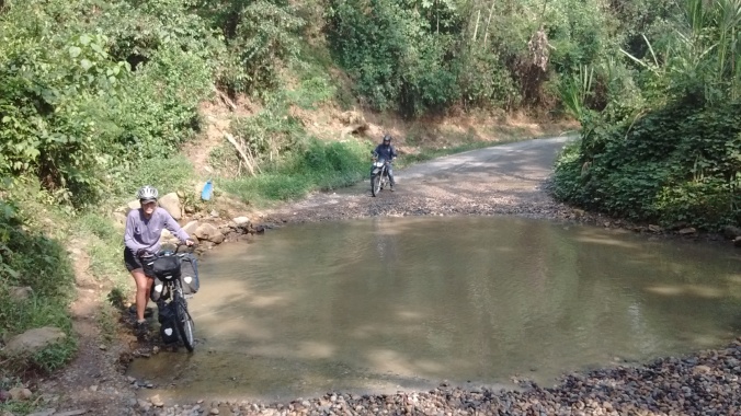
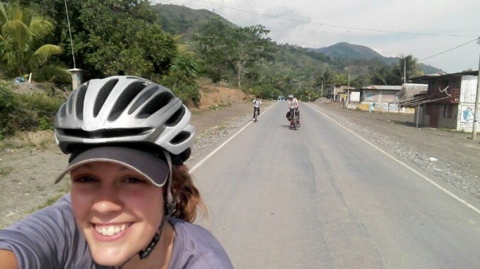
We’d planned to follow the Andes by Bike – Great Divide route, but ended up doing lots of on the fly route changes, to dodge the army of orange Peruvian road builders who are tarmacing Peru’s dirt roads at a rate of knots. A endless gathering of workers lining the roadside never failed to “entertain” us as we slogged up hill, with their “gringooooooo!!!!” . All meant in good jest but SO much harder to respond to in good humour when you are crawling past people at 6kph.  MUCH more fun when you are zooming downhill past them.

14766640862692.jpg

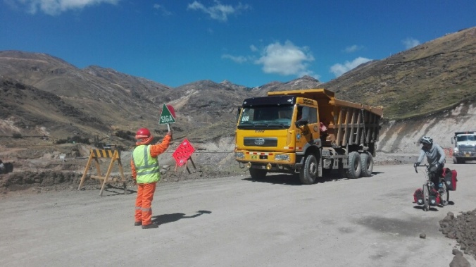
On your marks…get…set…..GO. Leaving Huancavelica and a few days of racing the tipper trucks trying to tarmac the road

Mostly, our routes choices turned out to be awesome, a mix of tarmac and lots of peaceful dirt roads lined with dozens of lakes, mountain views, unexpected hot springs to soak our road worn bodies, and friendly villages.  We started to enjoy looking at the map and purposefully trying to find different ways to head north.

We headed hrough river valleys where the only locals left in deserted villages were donkeys grazing in the sun…

14772498939640.jpg

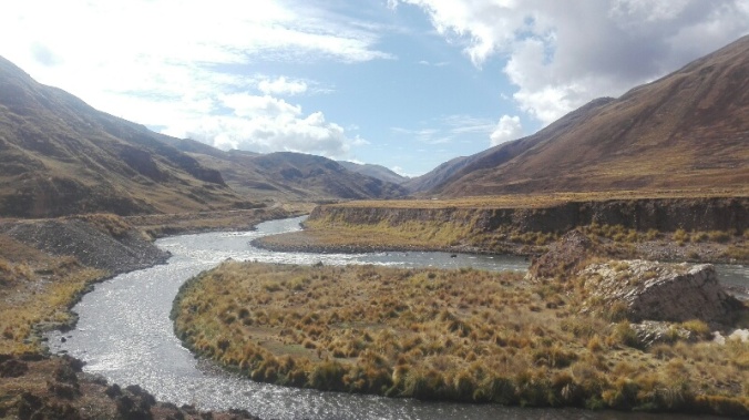
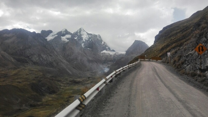
Leaving the tarmac after La Oroya and following the river


14772498937419.jpg

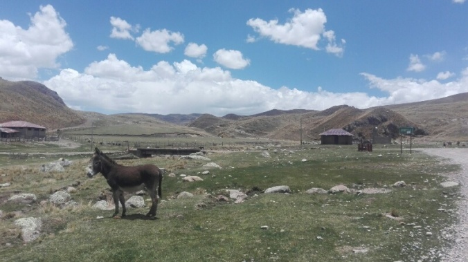
A lonely donkey and a deserted village


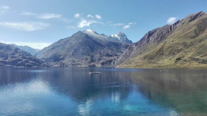
…around dozens of lakes of all kinds of colours…

14772498926073.jpg

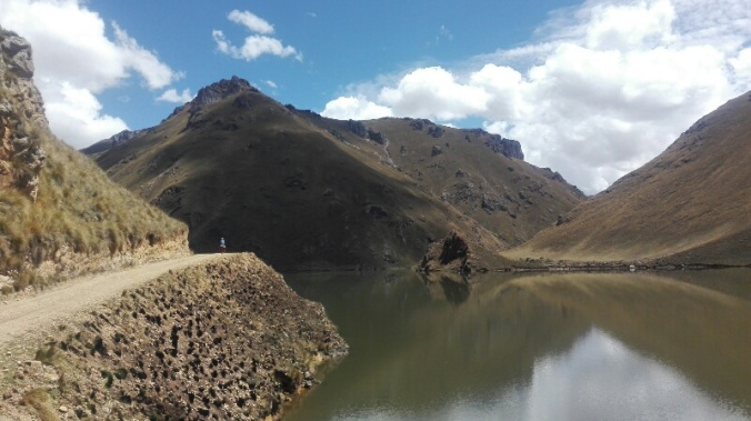
A last minute change of route from La Oroya proves to be a success as we spend the morning skirting around a huge lake

14777517426013.jpg

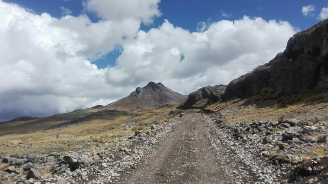
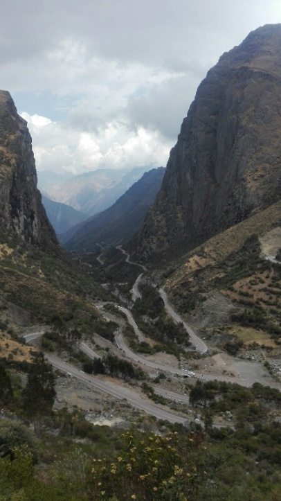
…and over dramatic mountain passes, each one revealing a completely differnt landcape on the otherside….

14772498908748.jpg

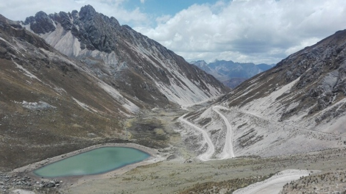
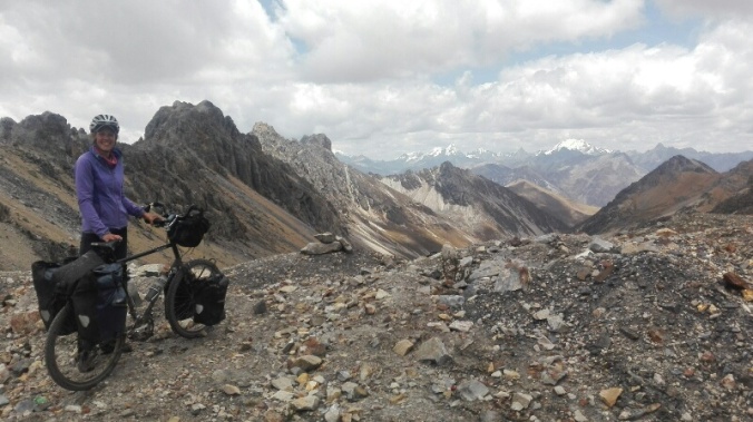
The reward for climbing up to 4700m, ready to zoom down to Picoy, and trying to beat the grey clouds on the horizon (we lost)

14777517399320.jpg

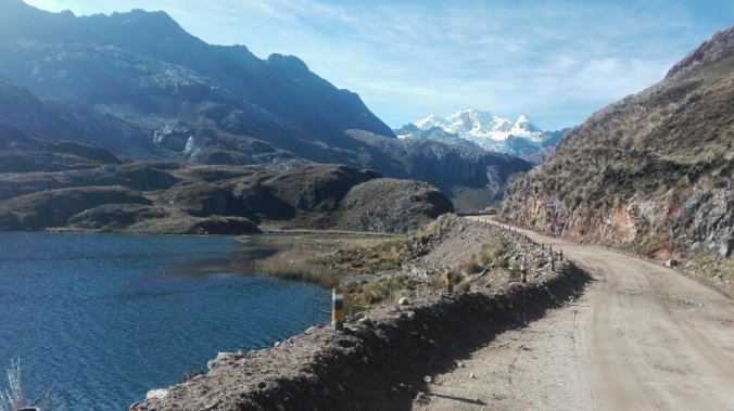
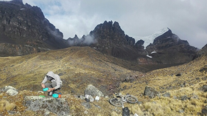
Our first view of the Cordillera Huayhuash climbing towards the Raura mine, including a huge glacier hanging between the mountains

14772498949285.jpg

Ummm….can’t remember where this was! But it looks pretty

We found some great wild camping spots, by glacial lakes, pink rivers and overlooked by snowy peaks….

14777517459922.jpg

Camping at 4600m on the Pastouri Highway.  After hiding under our tarpauline at the side of the road for a couple of hours the skys cleared to reveal a huge glacier behind us and a pink river running down from it


…including one where we unexpectadly woke up to this view, after pitching our tent in the near dark of a rainy, cloud covered dusk.

14777517463367.jpg

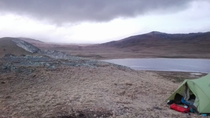
Camp spot after desending in the rain through a mining camp at Raura

14777517441493.jpg

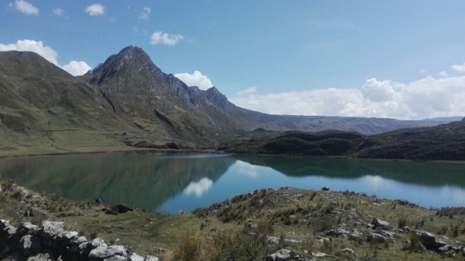
And another gorgeous lake that was waiting for us just around the corner

There were also some not-so great sleeping spots, including a patch of grass that turned out to be mostly made of cow poo, and some impressively awful towns and villages.

14766640880678.jpg

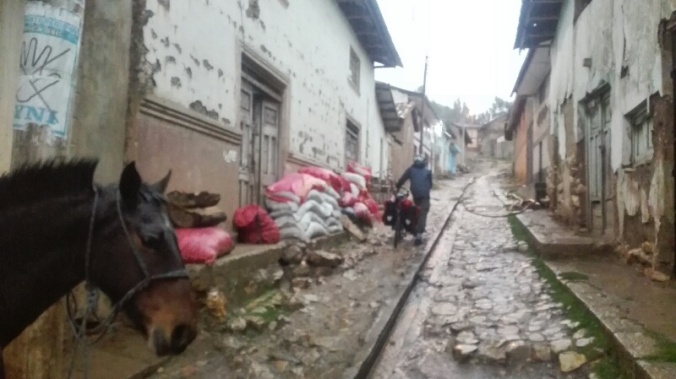
Another day, another beautiful highland village.  This one was Acostambo, which seemed to consist of one muddy street, a handful of roadside shops, and a lone horse wandering freely around.

Highlights  of awfullness included Rapaz, where our only sleeping option appeared to be a bed shared with the elderly (ancient) owner of the full hospedaje (for a fairly hefty fee!), in a room that smelt like it had been no stranger to death.  Then there was Oyon, home to an unusually high number of unfriendly locals, and where we ended up in several heated arguements with shopkeepers, hotel owners, and random people on the street calling us gringos.

But mostly, and especially away from the more well trodden villages on the Andes by Bike route,  “Giant” Tom and his facial hair continued to prove a hit with the locals…

…and we continued to scare the sh*t out of sheep all over the country

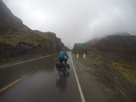
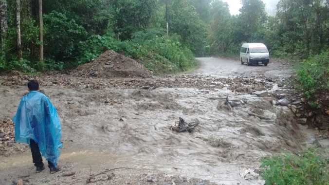
Our mornings were generally blue and brights, but rainy season loomed with some menacing grey clouds starting to gather by early afternoon.  Mostly we were lucky, and the clouds passed us by or we managed to take shelter in random villages, or get our tent up before the late afternoon rain started.

14772498942373.jpg

Good timing, tent up and brew on shortly before the downpour began

…but a few times we were caught out.  Time to engage poncho, industrial rubber gloves, and commence the failproof tactic of “hide under taurpauin for 2 hours”.

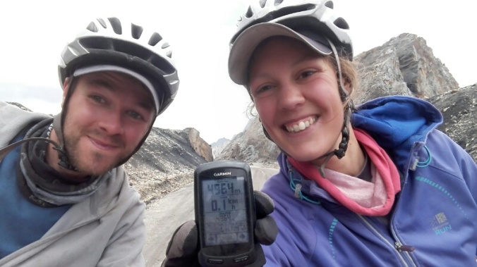
At Abra Rapaz, we hit out highest point yet on the bikes, a breathless 4965m, and achingly close to 5000m mark…

14772498915329.jpg14772498919020.jpg

….and hit an unexpected low when we a we took a “short cut” only to accidently descend 2500m .  Knowing we’d have to slog back up to get back to where we wanted to be (every 10 seconds of downhill fill, is at LEAST a minute of pain to get back up again!), sometimes, you just have to lie at the side of the road and pretend to be on a beach instead.
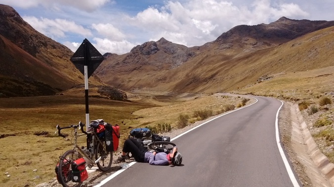
 

img_20161012_105521278

Legs say No


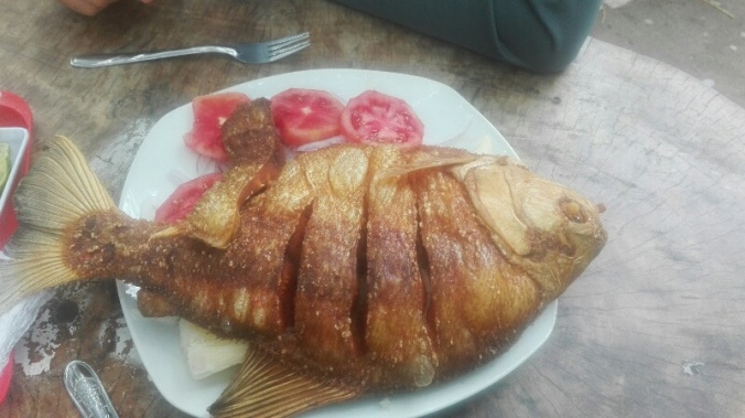
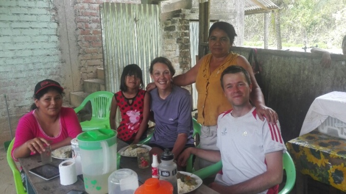
In the bigger towns and cities along the way, we continued to find time to work our way through our Peruvian, trying our first, then second (and safe to say, last) guinea pig, awesome Ceviche in Huancayo.  But mostly we continued to eat a lot of pollo a la brasa (chicken and chips) and

Signs in Huancayo and Huancavaleca entertained the teenage boy’s sense of humour in us as the referenced the traditional “Huanka” culture, and one restaurant name that we have no excuse for!

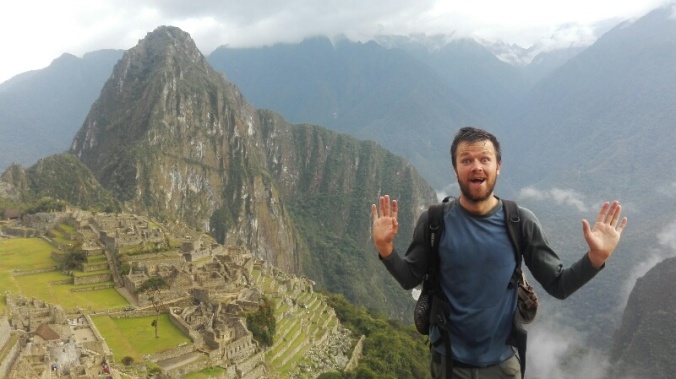
We arrived in Huaraz, feeling like conquerers of the Andes!  1000 kilometers, 21,500 metres of climbing and 10 or so moumtain passes cracked through in 18 days.

14800986340650.jpg

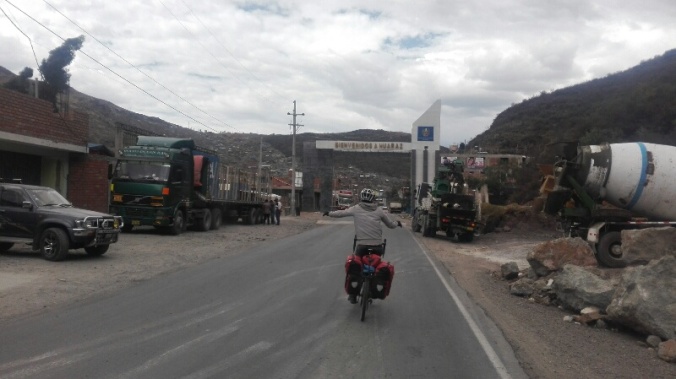
The “look mum no hands” celebration on arriving in Huaraz

But we’d really only just gotten started.  A few days  later we were off in to the mountains proper, donning the rucksacks again for an 8 day walk around the incredible wilderness of the Huayhuash circuit, then the 4 day Santa Cruz trek.  A perfect end to our time in the highlands, where the weather rewarded our previous few weeks of graft with an unseasonal week of glorious weather and blue skies. After weeks of glimpses and far off views, we finally saw the the mountains in all their close up, sun drenched glory.  Amazing.

A few photos from Santa Cruz…

and a few from Huayhuash…

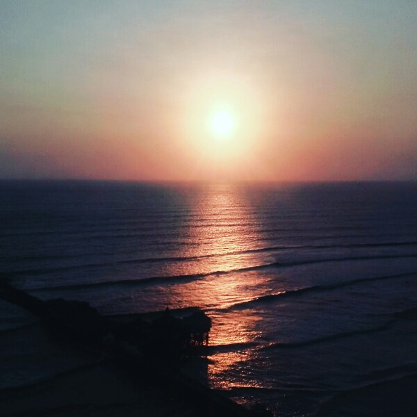
Finally ready to say goodbye to the mountains and dirt roads for a while, from Huaraz it was a dusty few days down to the coast where we joined up with the big old Pan American highway, ploughing north through the desert.  A complete change of scenery, but we’re looking forward to a few more gorgeous sunsets now as we head up towards Ecuador with the Pacific to our left.  First though, a few days in Lima (via bus!) where we shall be mostly lying by a pool, drinking pisco sours, and blowing more cash than we’e probably spent in a month on a single dinner at the world’s “13th best restaurant” Maido. Bring it on!

14803003582620.jpg


A jungley detour – Cusco to Ayacucho via the Narco lands

Back from our hiking sojourns around Cusco, and fattened up again after a few more days of post-hike indulgence, we couldn’t put it off any longer.  It was time to get back on the bikes and start heading North!

There wasn’t an obvioulsy appealing route out of the city, and most south bound cyclists we met in our hostel had arrived by bus to skip the hilly slog along a main road from Ayacucho.  Tempting (for me,as I fundamentally really only like cycling downhill!),but poring over our maps did reveal another potential route though. Some showed the line heading out of Cusco via the historic Sacred Valley to, dropping down into the jungle to Quillabamba, continuing to follow the Urabamba river to Kiteni and onto Kimbiri, before climbing back up into the highlands. Other maps, however, showed a road that fizzled out somewhere in the middle of a dense patch of green on the map. Interesting.


Kiteni map.png

A road less travelled from Cusco to Ayavucho and beyond

We could find tantalisingly little info about this jungle road,. Was it paved? Were there places to stay along the way? Was it safe?  Did it even exist!? Asking locals in Cusco, and Googling to try to find if others had cycled it came back with the news stories of the drug and terrorist related violence that flared up in the region in 2012.  The area is a prime growing region for cocoa leaves, the raw (legal) ingredient for (illegal) cocaine production, and had seen a resurrgence in Shining Path rebel activity in the early 2010’s.  Kidnappings, murders and violence plagued the region, and the rest of the country, in the 1990s but their activities had been fought back in the 2000’s.

video-imagen-4a_0

Nowadays the group are seen as being more aligned to drug trafficking than a political movement, and are much weaker.  After the incidents in 2012, a military base was installed in the region and from what we could gather, this appeared to have quelled the violence as we could find no incidents reported in the last 4 years.


I was torn.  Nervous about the news reports I was reading, but also reluctant to cast off a whole region because of something that happened 4 years ago.  We were really keen to experience this different side of Peru, only 90km from the highlands of the Sacred Valley but a completely different climate, landscape and culture, and were definitely  tempted by the prospect of cycling a road few other people had.  We used google satelite to zoom in on the road as much as we could, and could see a few sizeable settlements along the way.  We decided that if we made sure to be sleeping in towns, avoid camping, and cycle only in daylight, we would be fine.  So it was settled…off to the Jungle!

It took us 8 days of riding, a day recovering from heat exhaustion, one day attempting and failing to get to the Pongo (a place Michael Palin called his “favourite place to travel in the world”), and an unplanned but very needed collectivo lift out of the valley to make it to Ayacucho and we were so glad we decided to go for it.

The people we met along the way were without doubt the friendliest of our whole trip so far, and we were constantly turning down offers yelled from the roadside to stop for a chat.  The pace of life was turned on it’s head as we headed lower and lower and things got more and more lush and humid.  In the highlands, by 6pm people are huddled back in their warm houses to shelter from the onset of freezing dusk. Here, the town plazas came to life as the sun went down and the brutal heat of the day started to subside.  Ice cream, cremoladas (yummy blended fruity ice cream drinks) and all kinds of fresh fruit abounded, with roads lined with banana, mango, avocado and orange trees that made our mouths water but always seemed just out of reach! Being used to seeing women covered head to toe in traditional highland dress, now there were girls in shorts and strappy tops, men wandering around with bellies out, and an abundance of flesh that can only result from a life of plentiful food, cool Inka Cola, and lots of sitting around in the jungle heat.

We’d definitely recommend this route to anyone heading to or from Cusco….plenty of small towns with hostals and supplies, and a great way to see a different side of Peru. Just be prepared for the 3000m climb (or much less duanting 3 hour lift in a collectivo) out again!

Our jungle adventure:

Day one saw us leaving Cusco for Ollantytambo, via the Sacred Valley, the salt terraces of Moray, a unexpected bit of single track, and an incredible visit to the Sacred Valley Brewery where we drank IPA and got nostalgic about London.

Ollantytambo greeted us with a cyclist’s arse’s worst nightmare, cobblestones (damn those Incas), and sent us on our way to Abra Malaga the next morning with a 6:30am puncture.

Patched up, with a little crowd encouragement, off we went on our biggest climb yet, 1400m climb up to Abra Malaga at 4400m, spurred on by the knowledge that we would be duly rewarded with a 3000m downhill freewheel and pina coladas (surely??) by the evening.

14764919536545.jpg

All was well until we neared the pass, and our first real experience of the Peruvian rainy season sent us shivering under a shelter at the top. But there was no where to go but down, so for 25km down we went into driving rain and wind that soaked us through and froze our hands until we couldn’t brake anymore. It turns out downhills are not so much fun when you can’t feel your fingers, toes, arms, legs or face.

DCIM101GOPROGOPR1600.

Soggy Abra Malaga

Just when we were about to pass from freezing to borderline hyperthermic, we finally saw a sign of life and potential shelter.  A chalkboard at the roadside saying “Restaurant – Caldo de Gallina, Cafe & Te”.  Chicken Soup, Tea and Coffee. I momentarily worried that I had died from the cold and gone to heaven, but the stabbing coldin my limbs reminded me otherwise and we numbly limped in through the front door into a warm, dingy room, scattered with a few tables and chairs and with some happily oblivious guinea pigs scurrying around.  The owner took one look at us, shook her head in disbelief and scurried off to get wood to set a fire, served us up two huge mugs of coffee peruvian style (6 spoons of sugar) and a delicious hot soup full of potatoes and chicken. Wet clothes and bodies steamed themselves dry by the fireplace, numb digits came back to life and before we knew it the sun was shining again.   Now the downhill fun really began!

14764919475685.jpg

Bizzarely, I’ve actually cycled this road before….7 years ago on a backpacking trip to South America.  But that time they drove you up to the top, put you on bikes, and let you roll all the way down.  This time was even more fun for having slogged up, and it took us merely a couple of hours to zoom the 70km down to Santa Maria, the air getting warmer as we went, the valley getting lusher and finally on to Quillabamba in an incredibly noisy dusk, the trees coming alive with insects and birds.

14764919551564.jpg

From Quillabamba it was 300km or so to the end of our jungley adventure.  We rode through palm trees, dense vegetation and thousands of mango trees…


14764919453464.jpg

14764919509143.jpg

…stopping for our usual Sunday lunch in a packed outdoor restaurant, serving just one thing….

14764919524261.jpg

Fresh “paco” fish straight from the river, with boiled yukka. Yum.

…sampled lots of interesting jungle fruits…

…and drank a LOT of cremoladas to cool ourselves.  Disappointed at the lack of pina coladas, we created our own.  Coconut cremolada + rum = amazingness.

The jungle was definitely not the flat and easy ride we’d expected.  Lots of undulating, and then one mammoth day with over 2000m of incredibly sweaty climbing, eerily quiet roads and a very well baracaded military base at the top.  This was the stretch that was missing from our maps, and the soldiers at the base seemed a little surprised to see us!

Sometimes the road kind of disappeared….

img_20161007_144939390

…and some times it really disappeared….

img_20161004_065502143

A day trip to the Pongo was sadly foiled by a downpour that washed away the road and had us turn back

But we made a lot of new friends, perfect for our level of Spanish….

…some more welcome than others….

14764919468892.jpg

We picked up a new cycling companion….

14764919544188.jpg

…and got ourselves adopted by Daniel and his family, who hollered us in for some and fed us lunch.  It was hard to tear ourselves away from their invitation to stay and swim at “their beach”.

14764919550451.jpg

We arrive in Kimbiri, last stop on our jungle adventure happy but exhausted. Cycling and sweating in the heat over the big pass had taken its toll and I spent the next 36 hours comatosed under the cooling breeze of the fan, swatting mosquito’s whilst my body repaired itself. A 3000m climb back up to Ayacucho was not the best plan for recovery, so we hauled our bikes into a collectivo taxi and up the long dusty road back to the highlands to Quinoa, just in time for a fiesta that kept the chicharron cooking and the music pounding all night..  Cheating?  Maybe but as we climbed up the relentless, exposed and busy road in 3 hours rather than 3 days, I can’t say I was disappointed to miss out on the ride!


So in summary, we loved this route.  The cycling was toughger than we thought in the relentless heat, and there is definitely an undeniable edge to the area because of the cocoa growing and trafficking.  But with a bit of sensible planning, early starts and a LOT of water and bug spray, it’s a great way to do “that bit between Cusco and Ayacucho”.

How to hike independently to Choquequirao & Machu Picchu for under £100

We wanted to hike to Chocquequeroa and on to Macchu Pichu independently, a 9 day hike that we had read about in the Trailblazers Cusco guide.  This book has detailed info describing the route, but also says that you need to take supplies for the whole trek and recommends a guide/mules to carry gear.  Agencies quoted us over £600 each for a group trip.

We managed to do this trek independently, without a guide or mules for under £100 each, INCLUDING entrance tickets to Chocquiqueroa and Macchu Pichu) would highly recommend it to anyone with a decent level of fitness and a bit of independent trekking experience who is up for an adventure and can carry a couple of days of food and camping gear.   We found the trail surprisingly very easy to follow, with decent campsites and places to buy basic supplies most days.

Our blog of our trek in September 2016 is here, but below are some more detailed notes on the route to hopefully help others do it:

General notes:

  • The timings are based on our pace, which is fairly fast as we are well acclimatized .
  • Recommend picking up a map from Cusco or a copy of the trailblazers guide as a back, up, though the path is generally easy to follow, except near pass after Yanama (where the road can be followed if in doubt).
  • Parts of the trek are over 3000m so take some time in Cusco to acclimatize before starting
  • The trek is quite strenuous with some long steep climbs and descents
  • All campsites cost 5 soles per tent unless otherwise noted, and all had water, toilet and shower available unless noted (toilets and showers of varying qualities and costs!). All sites sold at least some food, ranging from snacks to dried foods and/or whole meals. Expect to pay about 2– 3 x price in Cusco.   g. Tuna 10 soles, bag of pasta 4 soles
  • In mid Septmeber 2016 we found all campsites open except one, potentially in the off season some of the shops/campsites may be closed.


Getting to start of trek

Cachora is the starting point for the trek.  Take bus to Abancay. Buses leaving Cusco main bus terminal (terrestro) at 6am, 8am, 9am and a few more throughout the day. Ask for desvio para Cachora. Takes 3.5 to 4 hours.  From this bus stop, you then need to take a collective to Cachora. There was a waiting collectivo at junction (10 soles pp), drive took 30 mins, walk would probably take 2 hours or more (16km).

We took 8am busfrom Cusco, had 30 min delay, arrived at Cachora at 1pm, had quick lunch and just made Cocamasana campsite before dusk (5.30pm). However, would recomend 6am bus or spending night in Cachora as this was a push.

Note – Previously it has been possible to start/end in San Ignacio but this is no longer possible due to a washed out bridge.  If just hiking to Chocque and back, the only option now is to return to Cachora

Cachora

  • Several hostels and hospedajes as well as basic restaurants/cafes. Despite what we’d read, it was possible to buy all basic food and drink supplies needed (fruit, bread, pasta, tuna, snacks etc.).
  • Didn’t see an ATM.
14764923330892.jpg

Map for the hike to Choquequirao from iPeru Tourist Office

Cocamasana

  • 4 hours from Cachora. Head on to trail at bottom left corner of the Plaza, kep heading downhill until you see a large sign for the trail, then follow signposts.
  • Descent from Cachora, then climb to Capuliyoc pass (2800). One waterfall before road ends to fill up bottles, and a shop/restaurant at entrance to park. Nowhere to buy food or drink after this. Then steep descent to Cocamansa with no other water source
  • Cocamasana is a basic campsite, three small sheltered pitches and open terrace with space for a few tents  Basic supplies were available- small range of soft drinks, pasta, sauce and tuna. Very basic toilets and running water.
  • Note – site was infested with sandflies, bring bug spray!  Would recommend continuing to next campsite if you have time.


Chiquisca

  • 1.5 hours from Cocamansa, steep descent  Two campsites, lower one was bigger with plumped toilet facilities, showers and sheltered area.
  • Well stocked kiosk selling basic foods (pasta, tuna, snacks, noodles etc) also sold bug spray, coffee, alcohol for stoves, and offered to cook meals.

Playa Rosalina

  • 1 hour from Chiquisca, steep descent.  Plumbed toilets with running water, showers, barbecue pits. Didn’t see a shop here.
  • Have to sign in to park here (no payment required). There is now a proper suspension bridge over river, previously was a cable car.

Santa Rosa Baja and Santa Rosa Alta

  • 1.5 hours to Baja and further 20 minutes to Alta, very steep switchbacks Baja had small tienda offering meals and snacks, drinks. Also camping anda shady spot to sit.
  • Alta was closed when we passed but sign indicating arrieros/horses available. Looked like a big, nice campsite when/if open

Marampata

  • 1.5 hours steep climb to a small village with several campsites and kiosks.
  • At least one campsite offers breakfast, lunch, dinner and arrieros. Almost certainly shower facilities though we didn’t look for them. We bought lunch at the largest (second) campsite for 10 soles for a large plate of potato stew with rice
  • At least three well stocked shops with all necessary supplies including some fresh fruit and veg.  This was the best stocked place until Yanama.

Choquiquerao campsite

  • 1.5 hours, undulating. 30 minutes to entrance where have to sign in. Fee is 55 soles pp. Map not included with ticket so take photo of paper map in shack
  • Free camping with ticket. Possible to stay multiple nights
  • Campsite had cold showers, toilets, washing facilites and running water but no food/drink supplies at all and no shelter.  Buy anything you need in Marampata.

14764923349550.jpgTake a picture of this map at the entrance as you won’t get another chance!

Choquiquerao ruins

  • 45 minutes from campsite. Two ways to go to main site. From top of steps immediately before/at campsite entrance, turn right for ‘main’ entrance via terraces and via turnoff to Yanama, was a shorter route. Turn left for entrance via truncated hilltop. Also a signposted route below the campsite to Paqchayoc.
  • Camping no longer allowed within the actual ruins, and nothing on sale at all, no bathrooms and no water source.  Take water with you from campsite.
  • Recommended to allow a full, long day to see all ruins including terraces below campsite

14764923351431.jpg

Pincha Unuyoc ruins

  • 2 hours from Choque campsite, 1 hour up to Abra Choquiquerao, 1 hour down.  To get on to trail, turn right at junction just before terrace entrance, to the Choqcue ruins, following a clear signpost to Yanama.  This is indicated on the hand drawn map that the guard shows you when you pay entrance fees.
  • Pincha Unuyoc has a few individual areas to wild camp, mostly in 15 minutes before ruins, but no organised campsite.  Water only available inside the ruins from irrigation channels that run through the centre.   Ruins infested with sandflies
  • Visitingruins/camping free, nowhere to buy supplies.

Maizal

  • 4.5 hours from Pincha Unuyoc, steep descent to riverbed and steep ascent.  15 mins before campsite, follow blue sign turning left for campsite (Valentin), where there was a tree branch blocking the other way.
  • Terraced site, lots of animals roaming free!
  • Basic supplies (rice, pasta, tuna, soft drinks etc.). We also managed to buy bread from campsite owner though probably not always available.  Offered to cook us lunch/dinner (for a price)
  • Cold shower for 3 soles and squat toilet for 1 sole, running cold water tap free to use


Yanama

  • 6 hours from Maizal, c1500m up to pass and down to valley floor.
  • Pass has spectacular views of snowy peaks, advised to get there as early as possible for best chance of clear views. Pass by mines on route up, can enter Victoria mine but was very dirty. Shelter at the pass with a small kiosk that was closed when we were there. Could possibly camp here in emergency
  • Yanama had a couple of large campsites. Very well stocked and cheap tiendas including fruit, veg, bread.. Also possible to buy gasoline from family in building to left of first campsite (ask around if unsure). We bought a cooked lunch from main campsite for 10 soles.  Recommend stocking up here.
  • Campsite had free squat toilet, cold shower and running water
  • Public telephone but not working when we were there
  • Apparently collectivos run from here to Totora and on to Santa Teresa but clearly irregular and we didn’t see any. More possible is to flag a lift with any trucks, we saw one such opportunity. Otherwise no traffic on road all day between here and Totora


Totora

  • 4.5 hours to Abra Yanama), 3 hours down to Totora
  • Follow path beginning immediately above main campsite rather than the paved road, Almost always shortcuts on path cutting across switchbacks in the main road, this saves a lot of time. Same on the way down but poor visibility meant we followed road a bit more.
  • Wild camping spots plentiful halfway between Yanama and pass when the valley opens up
  • Hornopampa 30 mins before Totora is first place to buy very basic supplies. Didn’t see any campsites
  • Totora had campsites with all facilities and fairly well stocked tiendas including fruit and veg. Didn’t try to buy fuel but no conventional petrol station
  • Not as nice as Yanama, glad we didn’t stay there, a little more traffic on road from Totora onwards


Ccolpapampa

  • 1.5 hours from Totora
  • We missed the trail and walked on the road which was higher up the valley and probably longer due to long switchbacks at end. Recommend to ask in Tatora for directions to walking path, but road was good surface and very easy to follow.
  • At t junction just outside Ccolpapampa, route joins Salkantay trek. Left to Machu Picchu, right then across river to beginning of Salkantay trek. To the right and across river is large area with buildings where groups on Salkantay seem to stay, presumably has all facilities, shops, alcohol etc.
  • Ccolpapampa is hamlet at bottom.  More basic supplies and more expensive than Totora and Yanama, but still everything you would need. Did have good range of fruit but bread was very stale. More focus on soft drinks and alcohol
  • Campsites had cold water, showers, western and squat toilet. Hot shower for 10 soles
  • Cafe which offered to do meals.  Could rent bicycles to cycle to Playa for 20 USD (they take your bags)


La Playa

  • 3.5 hours from Ccolpapampa
  • Passed a few small campsites/snack shops en route to La Playa, geared towards Salkantay groups. Main road goes on right hand side of valley but turn left and cross small bridge before main bridge to go onto walking path on left side of valley. Path undulates but mostly gradual downhill
  • La Playa has lots of tiendas selling all basic supplies, but more expensive than Yanama. Several campsites at far end of village.. Didn’t check facilities but assume has everything.  Also hospedaje at far end of village, (didn’t check price)


Lucmabamba

  • 30 minutes from Playa
  • Had lovely looking campsite (toilets, small tienda) with cafe selling proper coffee and meals. This and a number of places in following 30 minutes sold coffee and nice honey (small jar 10 soles)


Llactapata

  • Just over 2 hours from Lucmabamba, steep uphill then just over pass
  • Interesting looking ruins and great view to Machu Picchu, try to stay here
  • One campsite with restaurant and very basic snack and alcohol shop (didn’t sell any supplies needed for meals). . Noone there when we arrived e.g. for cooking food, so suggest arriving with supplies to cook for yourself.
  • 8 soles to camp, 10 soles for hot shower, unclear if cold shower is free (same cubicle as hot shower, we managed to use it for free but when no one around)


Aguas Calientes

  • 1.5 hours down to Hidroelectrica station which had lots of small tiendas, restaurants and one hospedaje that was closed when we were there.
  • 2.5 hours along railtrack to Aguas Calientes. Two campsites, one 30 minutes and one (municipal) 15 minutes before AC. First one had beach on river with a couple of spots, but mostly pre erected tents. Municipal campground looked better. 15 soles per tent and 30 soles for preerected tent at first place. Also had snack/booze shop, cold showers, toilets and running water.
  • Dozens of Hostals etc. In Aguas Calientes and restaurants, cafes etc. Try 4×1 pisco sours!


Machu Picchu

  • Must buy tickets in advance in Aguas Calientes, was an official ticket office off northeast cornere of square. Tickets to MP and MP plus MP mountain (only 7am slot) available, MP plus WP and MP plus MP mountain (9am slot) sold out.
  • Cross bridge near municipal campground, which opens at 5am and follow trail up. Took us 40 minutes but 1 hour more reasonable. Many people doing this walk
  • We arrived at 6.30 and large queue, but didn’t feel too full inside at this time after getting past bottleneck just past entrance
  • Coffee shop (around 10 soles for americano) with snacks, and very expensive buffet restaurant
  • Lots of people taking bags of all sizes in (including us) but apparently officially over 20l not allowed and no bottles or food allowed.  We managed to take in food and drink no problem.


Transport back

  • Walked back down tracks same afternoon as MP, lots of people at Hidroelectrica in mid afternoon hawking for collectivos back to Cusco direct (could get out at Santa Terasa/Santa Maria if wanted). Cost 40 soles pp, 6.5 hours for trip to Cusco.

Tips

  • Bring plenty of bug spray!
  • Trail to Choque in particular is steep and sandy in places. I managed in trainers, but hiking shoes probably better
  • Water available at all the campsites so no need to carry too much, but take a water purification method
  • Dogs/animals at all campsites. Bring earplugs!
  • Take small notes to pay for campsites and supplies
  • Start the hike up to Machu Picchu at 5am to esnure best chance of beating the crowds.

Costs

We worked out that we spent less than 450 soles each on everything, including food, transport, camping, entrance tickets (but excluding a slightly boozy afternoon spent in Aguas Calientes!).  That was about £100 or $130 USD at the time (September 2016).  A rough breakdown below:

  • Bus to Cachora turn off – 30 soles each
  • Collectivo to Cachora – 10 soles each
  • Camping fees – 6 nights @ 5 soles, 1 @ 8 soles, 1 @ 15 soles
  • Food bought in Cusco (4 days initial supply) – 100 soles (pasta, porridge, tuna, cheese,boiled eggs, noodles,buscuits, chocoloate, avocado, tomatoes, bananas, ham, bread)
  • Remaining food and snacks bought on trek (4 day supply) – 130 soles
  • Cooked meals bought on trek – 20 soles each
  • Entrance to Choquequirao – 55 soles each
  • Entrance to Machu Picchu – 142 soles each
  • Transport back to Cusco – 40 soles each

The one where we accidentally walked to Machu Picchu

Rewinding back to September (is it really now November!??), our time in Cusco felt like we were actually on holiday, with blue skies and lazy days. Breakfasts were late and al fresco in the courtyard of our hostel, afternoons were spent plodding the beautiful cobbled streets gawking at the mash up of Inca and colonial architecture , dusks spent over shameless Starbucks coffees and skype calls, and evenings passed putting my newly regenerated liver to the test with happy hour pisco sours. Folks cycling through Peru (yep,it turns out we arent the only ones!) congregate at Hostal Estrellita when passing through town and it was rather lovely to spend a few days surrounded by bike parts, route chat, and people with similarly excessive appetites to ours. Speaking of appetites, we may have indulged just a little……


We abandoned the fried chicken shops and guiltily left the other more thrifty cyclists at the hostel cooking up their pasta dinners to treat ourselves to some good grub.  Highlights for us were incredible Ceviche at Olas Bravas, a date night at Morena, which felt like being out in London (custoer service! cocktials!), and Bistek Montado at San Pedro market. A pile of beef, chips, avocado, egg, sausage, salad, rice, and a dangerous introduction to fried chese as an acceptable source of protein.  Looks horrendous, tastes incredible.

Two days of indulgence turned into 3, then 4, but finally it was time to get our bodies moving again, this time on two feet rather than two wheels. Bikes stashed, rucksacks rented and 14764923305623.jpg
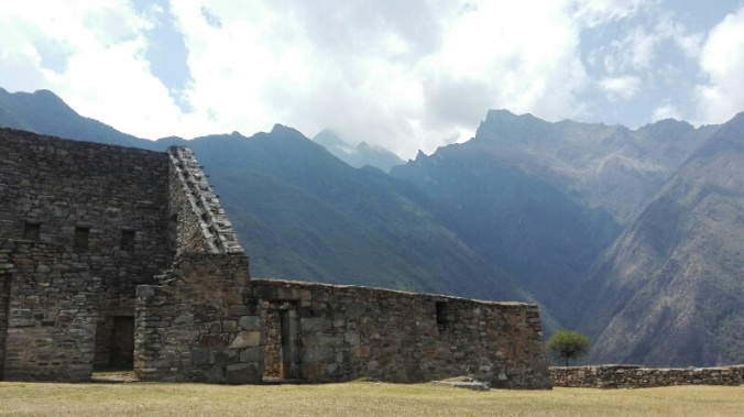
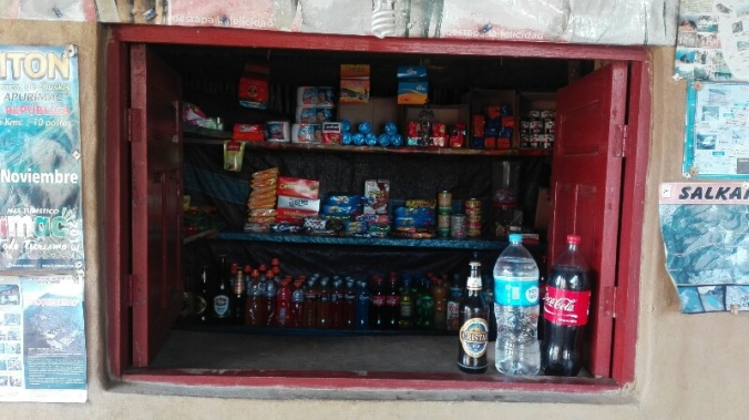
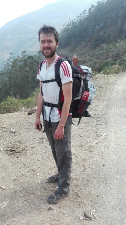
stuffed with supplies, we first had the hidden Inca city of Choquequirao in our sights, only accessible by a bus, collectivo then a two day hike in and one back from the town of Cachora.   Never ones to risk being left hungry, our bags resembled a mobile food market, with 35 bread rolls swinging from them, a kilo of pasta, boiled eggs, avocados, cheese, and an impressive array of buscuits, chocolate, coffee and bananas that would keep us powered for 4 days. Nevermind the fact that I’d only packed one pair of socks to make space for all these goodies. Priorities!

From Cachora we left roads behind, and slogged up one gorgeous, but bloody steep valley and down  the next, between basic campsites. The views were down lush hazy valleys covered in green with raging rivers running through them, and off to mountains on the horizon.  After so much stealth camping on the bikes where we pitch up late in hidden spots (often shared with cows/lamas/undescribable amounts of animal poo) it was a novelty to be able to pitch our tent in the afternoon sun and make a brew in peace.  Well, relative peace – we usually had a few thousand flesh-hungry sandflies and a barking dog or six to contend with  (this is Peru after all!).

We were feeling strong with our new legs of steel, and got a little carried away with all the walking. Our 3 day hike somehow turned into 9, and 125 kilometres and eight consequtive dinners of tuna, pasta and tomato sauce later we found ourselves looking at sunrise over Machu Picchu!

14764923305392.jpg

How did we end up here!??

We’d read that there was a trail linking the two hikes, but struggled to find reliable info about whether we would be able to do it without a guide, or be able to pick up food along the way. The tourist information (iPeru) office in Cusco was helpful, but their rep had taken a sharp intake of breath when we’d suggested setting out on our own, whilst tour agencies rubbed their hands together and quoted over a grand for to take us.   So instead we set off on our mini adventure to Choquequirao .  Which in itself, was amazing enough!

We reached the Choque ruins on day two, sprawling across a hillside of a huge valley, and thanks to being so cut off from road access, with very few visitors (we counted about 10 people when we were there!)  . The site’s only employee welcomed us with a hand drawn map of the complex, and we were allowed to camp there for free, clamber over the whole site the next day,  and pretend we were Indiana Jones.  Exhausted after a whole day spent exploring the and scaling the near vertical Llama terraces that miraculously cling to the steep hillsides (those Incas must have had thighs of steel!) we happily spent a second night at the campsite watching the sun set over the hills. Apparently there are plans afoot to make the ruins accessible by cable car in the next few years and make this the “next Maccu Piccu”, but looking out at the dense, unpopulated valley all around us, we have no idea how!


So how did we end up at Machu Piccchu? In the small village of Marampata before the ruins,  whilst scoffing an unexpected hot lunch cooked up for us by the owner of the campsite, we’d spotted a poster on a wall and some info describing the onward trail to Maccu Piccu.    We mustered our best Spanish to ask some of the locals about whether the trail was easy to follow, and got positive responses. Add this to the fact that the shrewd señora who had served us up our  had also set up a well stocked shop selling everything a hiker could need for a few days, and our minds were made up.  On to Machu Picchu!

14764923233588.jpg

Re-stocking in Marampata – everything you could possibly need to carry on walking (including a healthy supply of booze)

On we walked for 5 more days, eventually joining up with the Salkantay Trek which is a popular trek for groups of backpackers to the ruins, .  It was an AMAZING hike,  the perfect combination of isolation  (we saw only 5 other tourists),  a challenging but logistically easy walk, with one clear path to follow, and simple campsites with small shops at just the right distances.  The scenery constantly changed as well, and the second stretch was even better than the first.  One day we were we were building snowmen on the top of Yanama pass and the next we were walking through coffee plantations and picking oranges off treeson the valley floor. We loved it.

There were sweaty jungles, river crossings and huge butterflies….

Then snowy passes, valleys like the Scottish Highlands and our first peak at the snow capped Peruvian mountains…..

Always with a gorgeous place to camp, a cup of coffee, and a Sublime bar waiting for us at the end of the day…..

The final day was a walk along train tracks to Aguas Calientes, jumping off point for Maccu Picchu and a sudden throng of thousands of tourists, pizza restaurants and hotels.  We camped by the river just before town, and rewarded ourselves with a dip/shower in the Urabamba before heading in to town to indulge in a proper coffee and more than several celebratory “4 for 1” pisco sours.  .

After one too many snoozes on the 4am alarm thanks to my pounding pisco head and the equally pounding rain on our tent, eventually we did get up and at 5:30am raced up the 1500 that take you up to the ruins from the valley floor. Yes, there were crowds, there was a persistent drizzle, and there were far too many rules and over zealous security gaurds constantly repremanding us. But it was still Machu Picchu, and there is no doubting that it is pretty damn incredible……

14764923239361.jpg

6:30am, and my best picture that pretends we were the only people there!

DCIM100GOPROGOPR1456.

A rare photo that proves we are actually travelling together

DCIM100GOPROGOPR1450.

So we treked for 9 days and saw two of the most impressive Inca sites in Peru for under £100. We’ve even written up some notes to help others do the same- see How to hike independently to choquequira machu picch for under £100.