Our final stretch – so long South America!

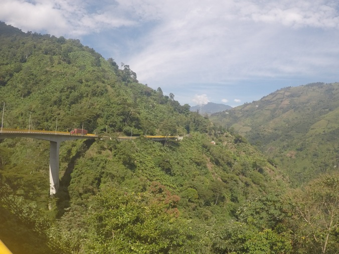
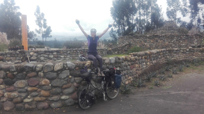
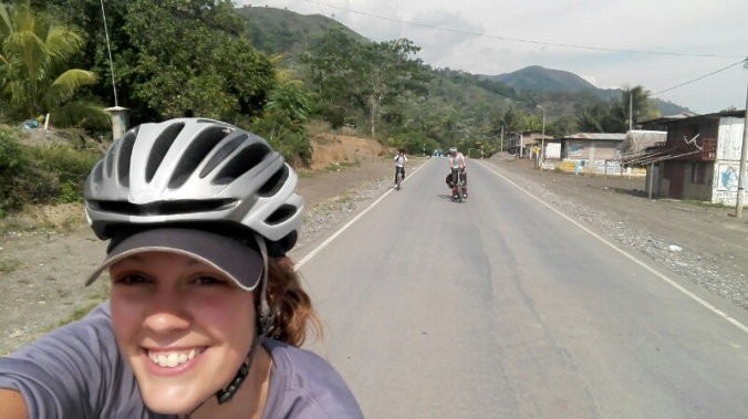
Aside from a couple of near death experiences and a day one drenching, our final stretch in South America turned out to be one of our faves of the trip. Taking a winding route through the last bit of Colombia from Medellin, through the colonial heartlands of Boyaca and Santander, then the humid wetlands and finally on to the Caribbean coast at Cartagena, it managed to cram in a little bit of everything. Gorgeous colonial plazas and churches, misty highlands, sweaty lowlands, waterfalls, rivers, lakes, dirt roads a plenty and two recovered and healthy bodies to enjoy it! All served up with the usual large dose of the lovely Colombian hospitality that we’ve gotten used to.

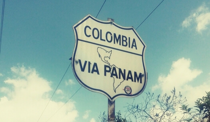
So that’s it! We’ve run out of continent to cycle….so we’re off to another one! With bittersweet tears in our eyes (probably from all the sugar we’ve devoured in the last 11 months), it’s so long Colombia, so long South America….USA here we come!

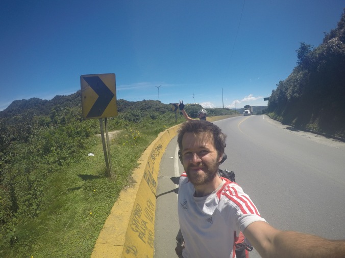
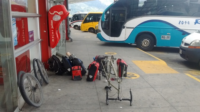
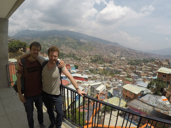
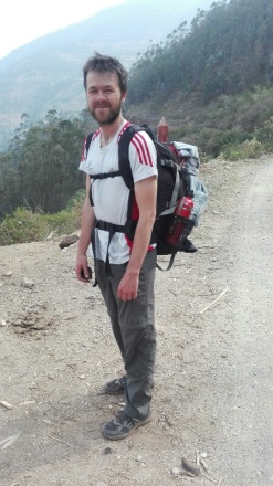
Our month’s stay in Medellin, volunteering, spanish lessons, sitting around eating pizza (me) and gym-ing (Tom) did it’s job of giving us the mental and physical break from the bikes that we needed. We were ready to get on the road again.

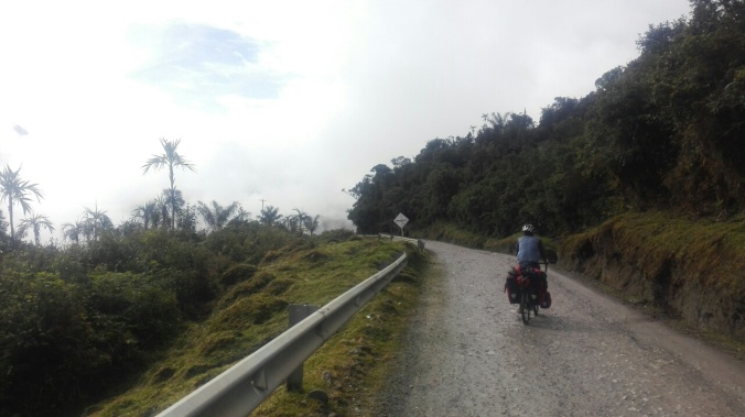
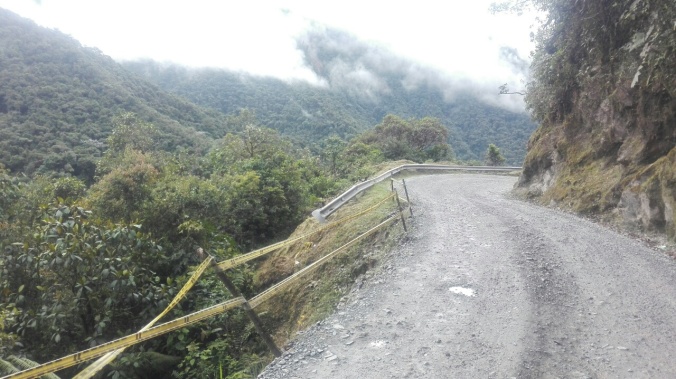
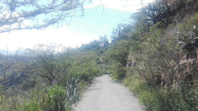
We started as we meant to go on, straight into the hills and on to dirt roads. My intense Medellin exercise regime (walk to shop, buy cake, eat cake) paid off, and the 1000m climb starting immediately from our doorstep in Medellin was a breeze, honest.

DCIM100GOPROGOPR3120.

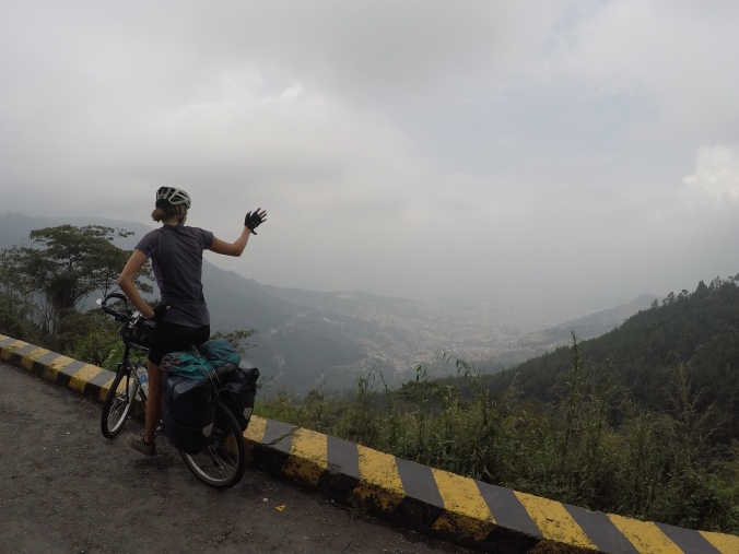
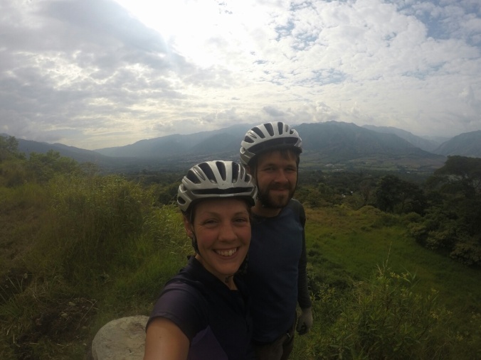
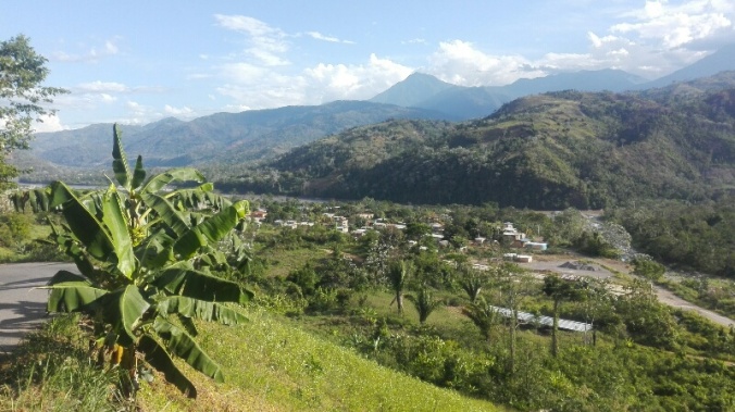
So long Medellin! The city in the valley below

IMG_20170325_133524

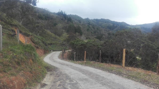
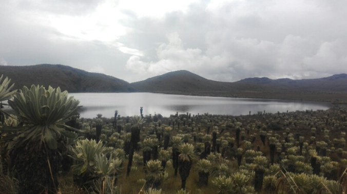
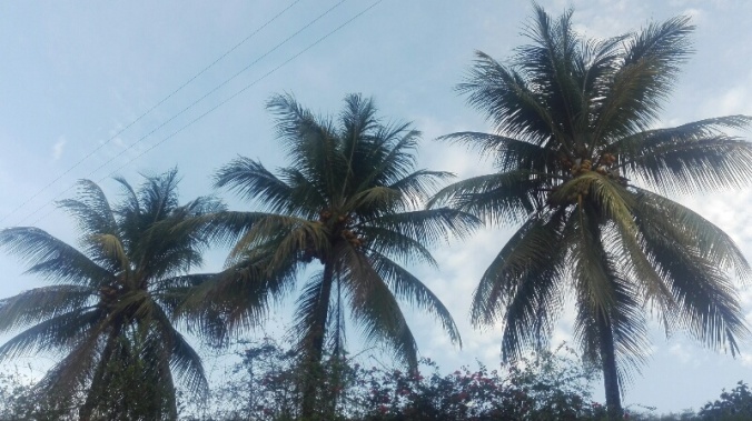
Off onto the back roads, fresh air after a month of smoggy city

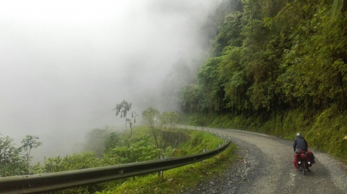
The weather teased us with a huge thunderstorm on our first afternoon….

GOPR3127.JPG

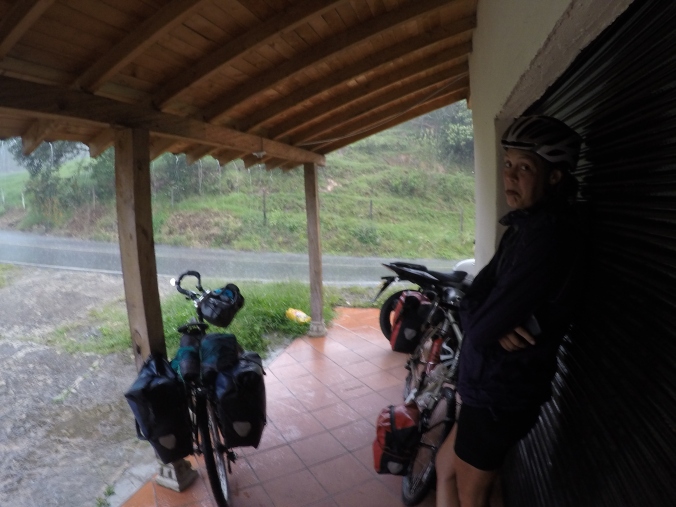
Our first day out of Medellin all got a bit soggy

….but we lucked out in our choice of roadside café to hide from the storm. Accidently stumbling into a a hippie commune/vegan bakery/artists workshop outside of Guatape, Walter and the lovely group of 6 permanent resisdents, 3 kids and a few floating visitors heaped food and hot chocolate on us all evening and invited to stay for the night. Yes, there was an awful lot of hugging, and subjects of the evening did include UFOs, spiritual portals, and some very open conversation on tantric sex over breakfast (all in Spanish – I honestly thought we were still talking about baked goods until half way through the conversation!). But mostly, there were lots of laughs, lots of fun, music, dancing, and general merriment. A lovely bunch.

IMG_20170325_212204.jpg

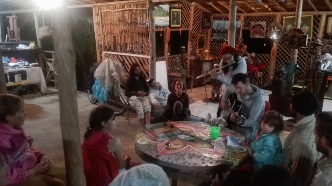
Singing for our supper

Leaving our hippie friends behind, the sun came out and didn’t leave us for the rest of the trip. New heights of cycle chic were reached in desperate attempts to stay cool and un-lobstery in the tropical sun….

GOPR3292.JPG

A great look I reckon. Sports bra, high vis vest, sleeves and a straw hat. Anything to keep cool!

…and any pretence of camping were soon abandoned in favour of our new gods – air conditioning and fans!

DCIM100GOPROGOPR3513.

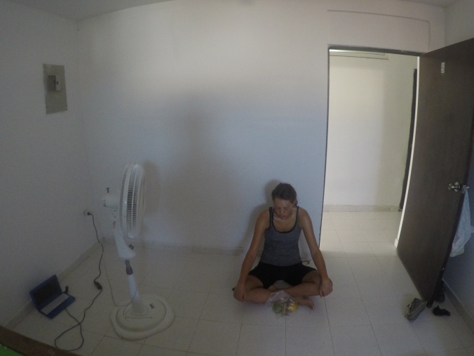
Worshiping the fan-god

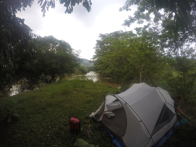
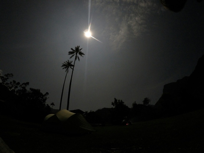
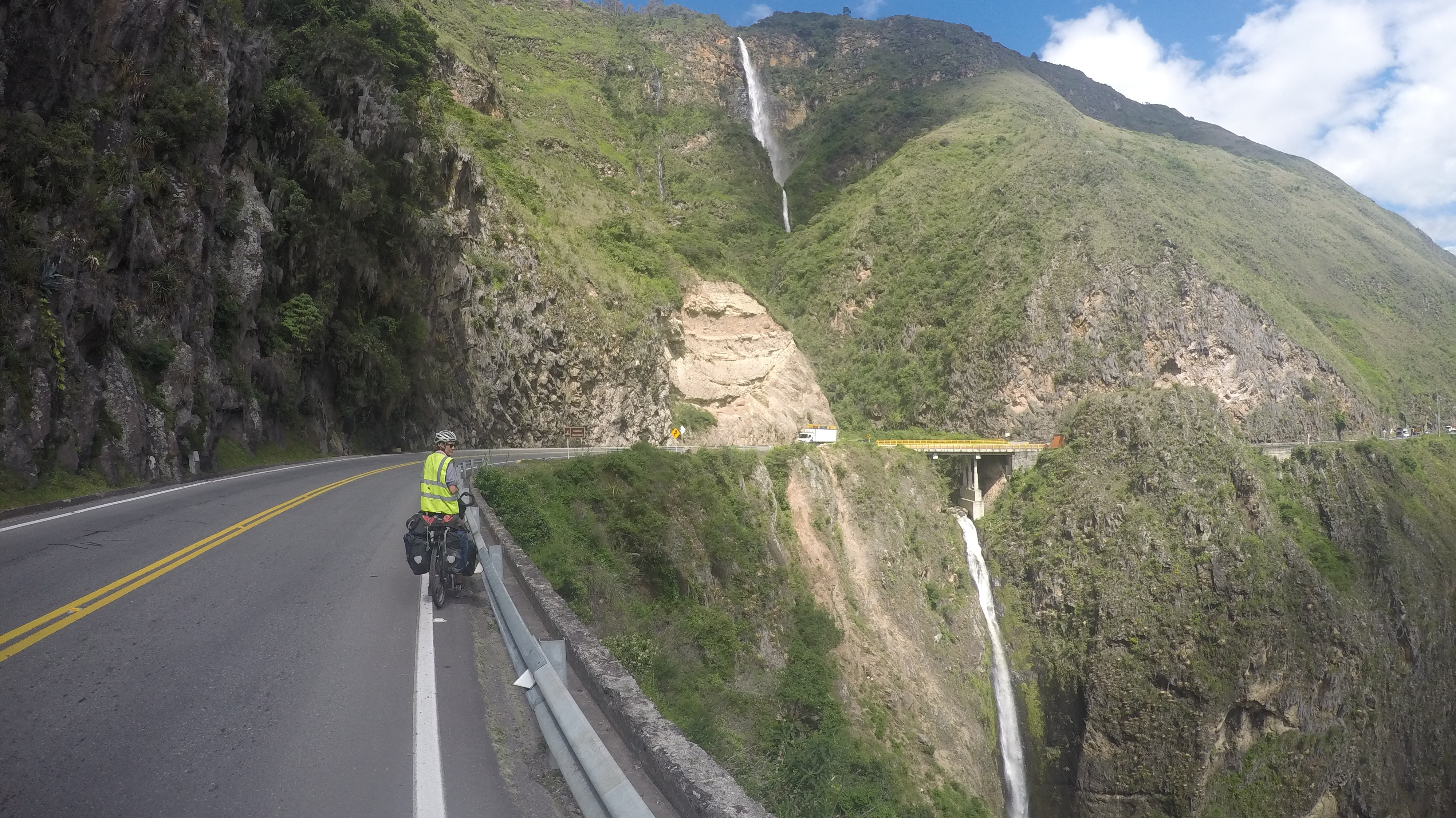
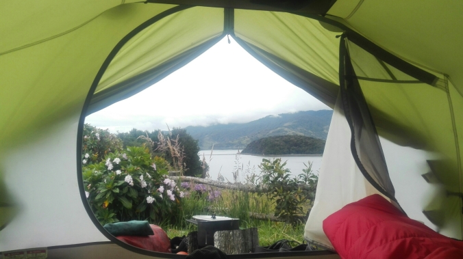
We did manage a few night camping, mostly soundtracked to the sound of waterfalls and ribbiting frogs…

IMG_20170403_185836.jpg

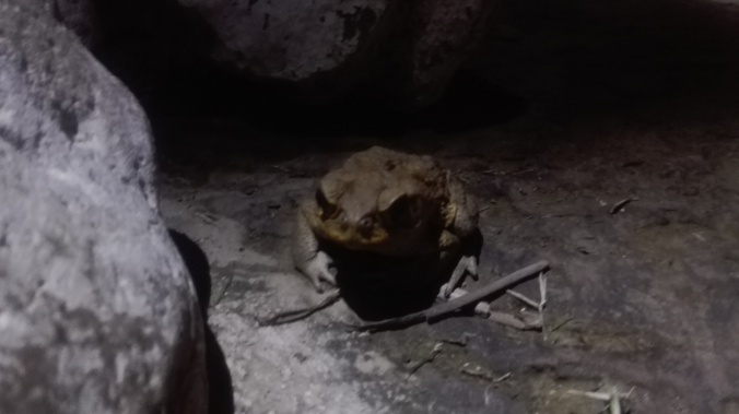
Massive frogs, noisy sods too

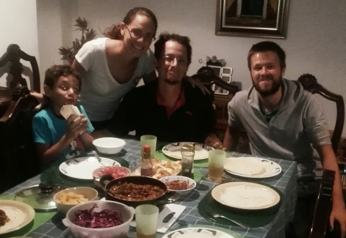
…and also one night in the garden of Nelson and his family, who took us in as we asked around for a spot to camp. Nelson, his wife and their 7 (!) kids soon invited us in for some food, and we spent the evening helping the kids with their English homework and causing lots of giggles over our Spanglish attempts at conversations.

GOPR3239.JPG

Riverside camping in Hector’s yard. We attempted to go for a wash in the river and got stuck in quick sand.

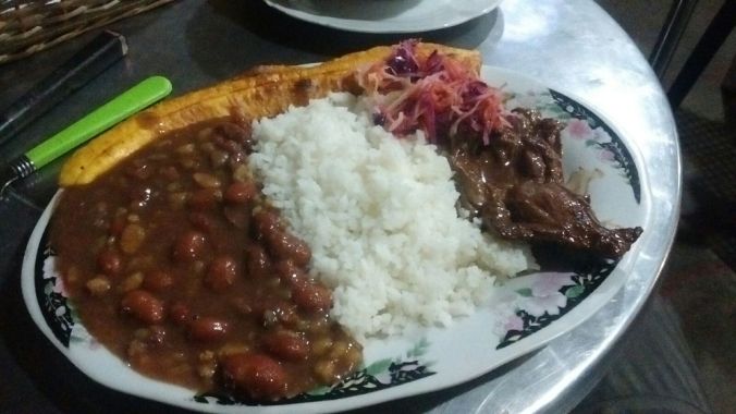
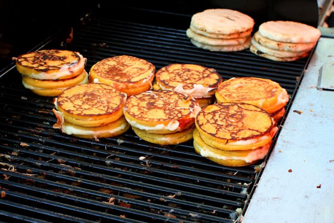
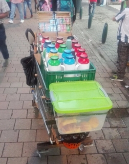
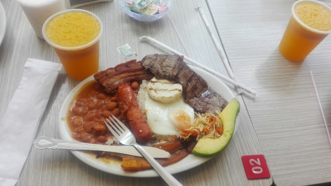
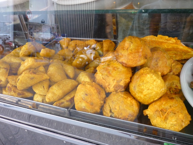
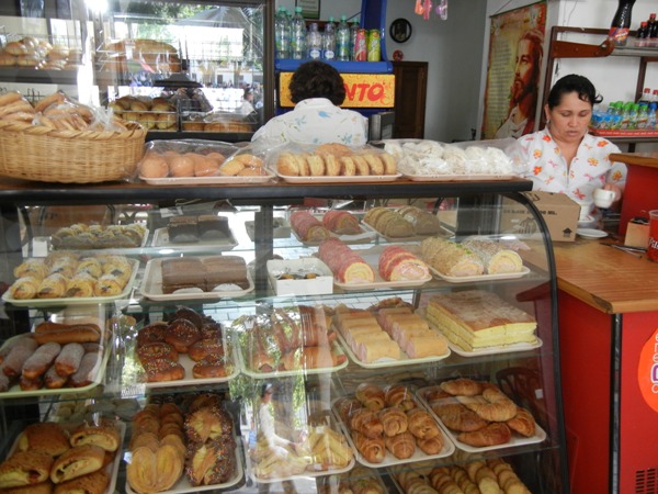
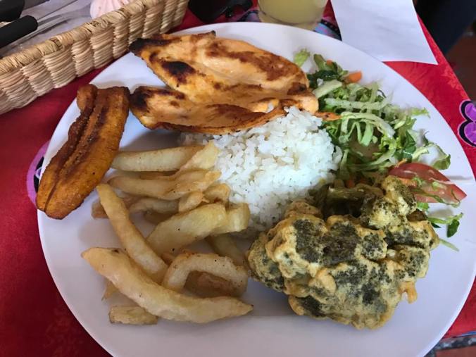
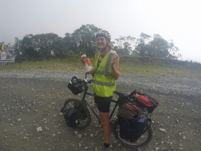
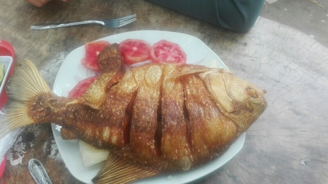
Our love-hate relationship with Colombian food continued, with some new stars. Walter’s feast of arepas de choclo and meat almost managed to undo the damage done by dozens of stale arepas so far on the trip, and raspicos, (a cup of crushed ice covered in fluorescent sugary syrups and condensed milk) became a regular feature of our hot days. In Velez, small roadside factories cooked up Bocadillo, a fruity jam confectionary, served up with a bowful of cheese and hot caramel sauce. It was ridiculously delicious (and free, thanks to the lovely Maria who refused to take payment from us!), and my lack of horror at this being considered an acceptable dish made me realise that I may now be at least 25% Colombian.

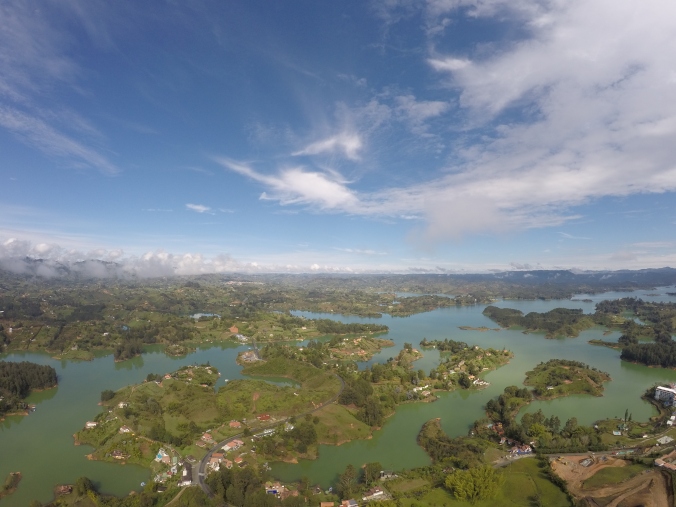
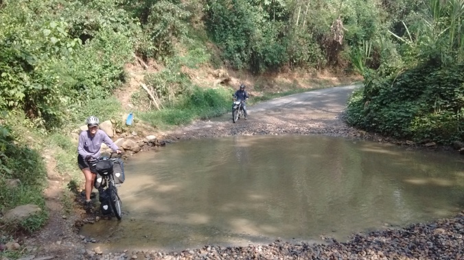
The last leg of our trip was a watery affair and we took every opportunity to get off the bikes and into the water to cool off. Starting with the gorgeous Guatape lakes…

DCIM100GOPROGOPR3179.

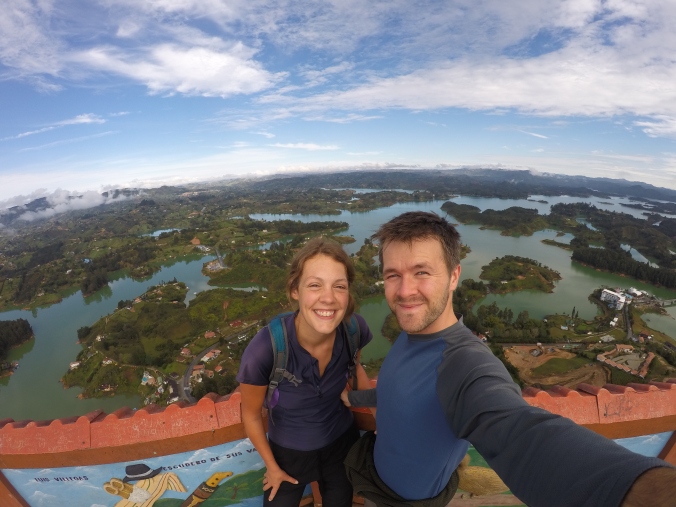
Pretty pretty Guatape, from the top of the Piedra de Penol lookout

DCIM100GOPROGOPR3190.

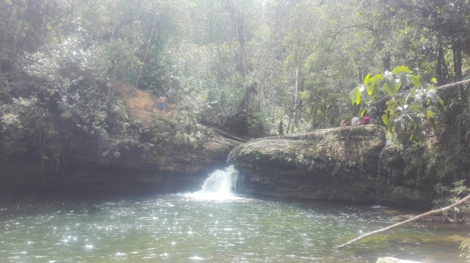
…. then the waterfalls around Alejandria….

DCIM100GOPROGOPR3222.

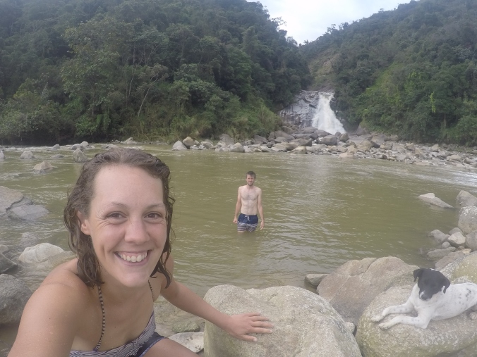
An afternoon dip at the waterfalls near Alejandria, with our new canine buddy

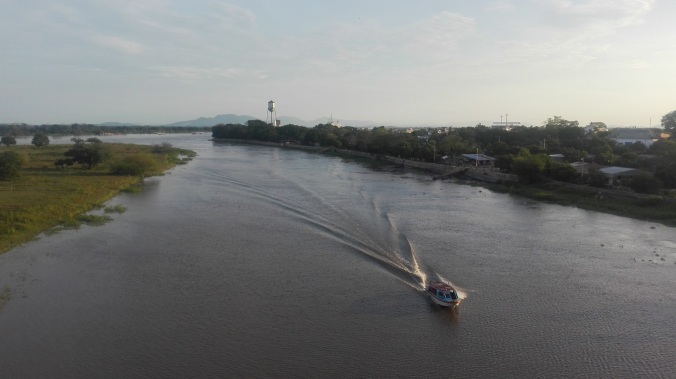
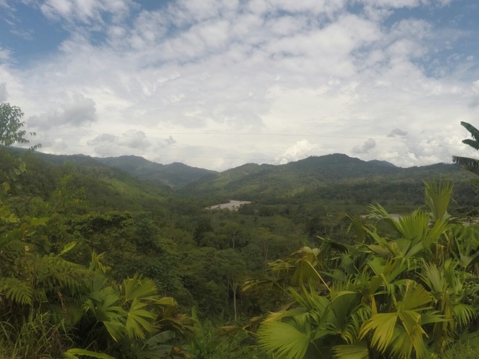
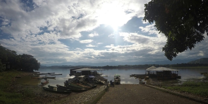
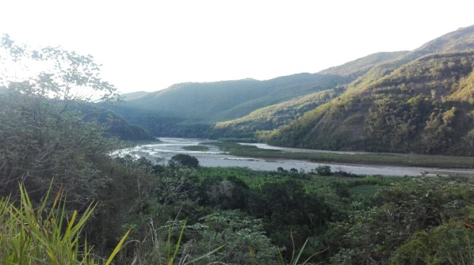
…..the mammoth Magdalena river slicing the country in half and feeding the tropical wetlands around Mompox…

IMG_20170411_172439

….and finally, the beach!

IMG_20170418_132821

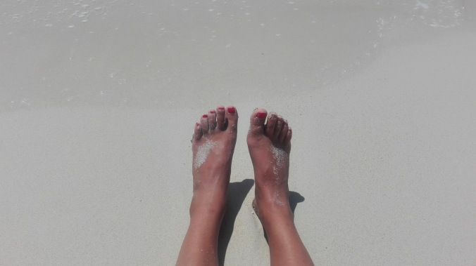
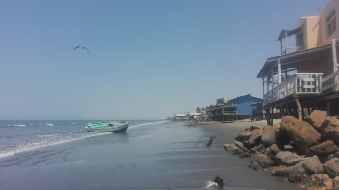
Dipping our toes in the white snds of the Carribean near Cartegena

We couldn’t resist the bizzare Chicamocha water park, which wins the prize for shittest slides, but most incredible location perched on the edge of a 1500m deep canyon….
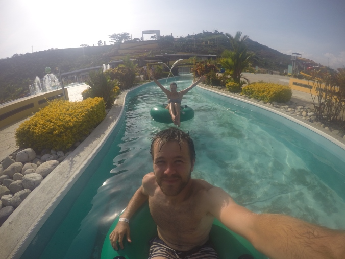
DCIM100GOPROGOPR3354.

Best. Fun. Ever.


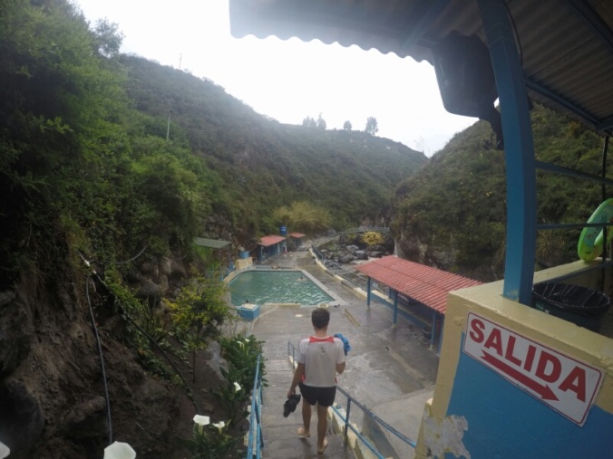
…but best swim spot of the trip goes to the beautiful natural pools at Pescadarito. Even my spectacular face dive on to a rock, and Tom throwing his phone in the pool couldn’t ruin the day.

IMG_20170407_112407

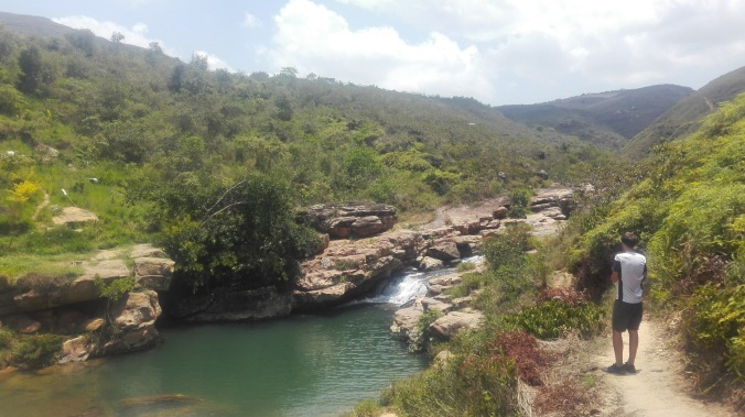
The gorgous pools of Pescadarito (pre face-plant and phone toss)

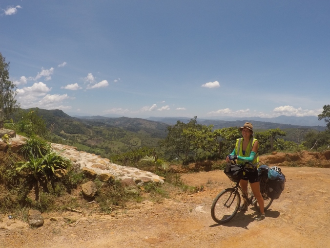
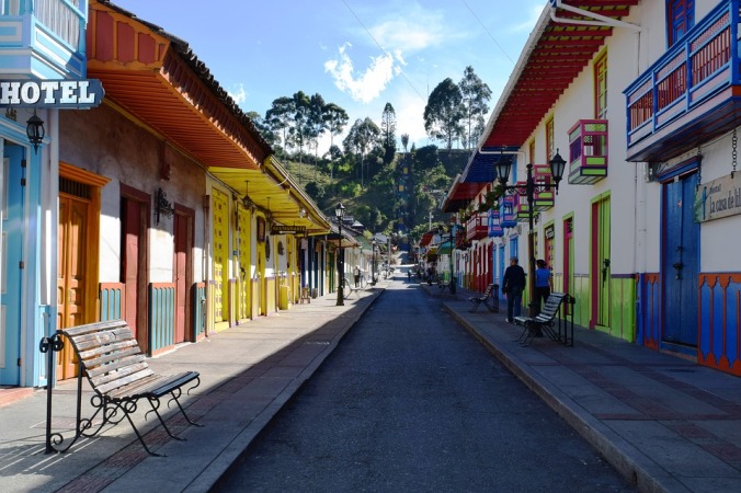
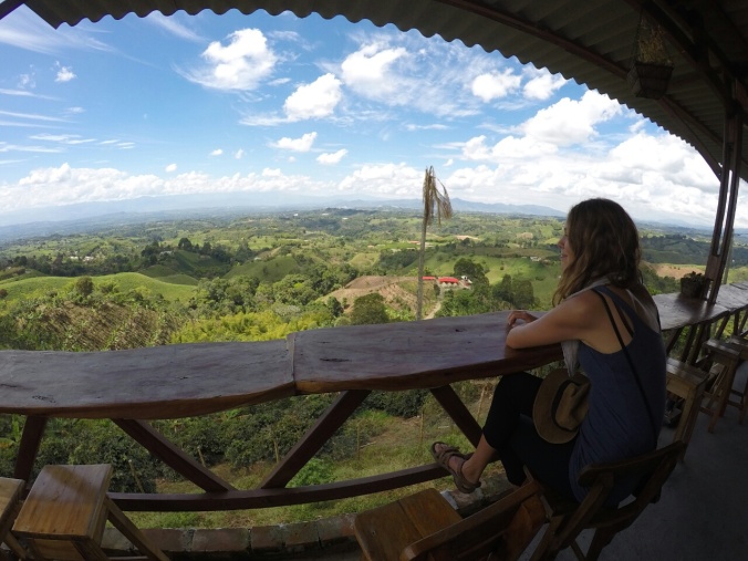
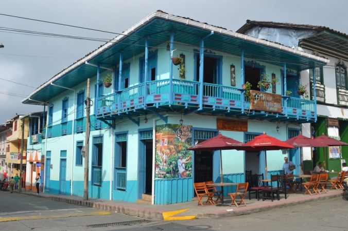
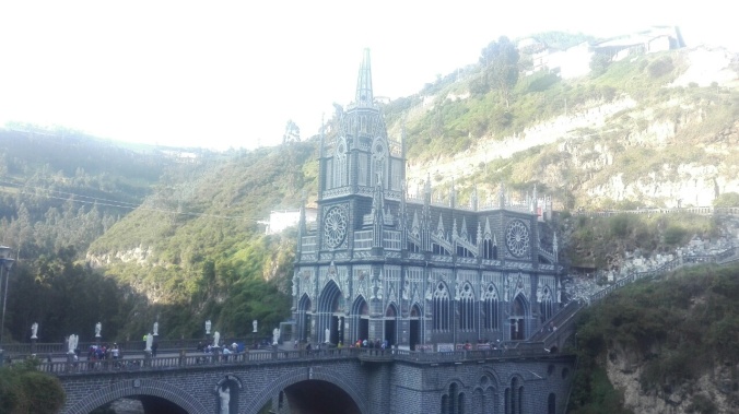
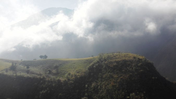
We spent most of the remaining time in the hills hopping between gorgeous little villages and towns, all trying to outdo each other with their pretty plazas and friendly folks.

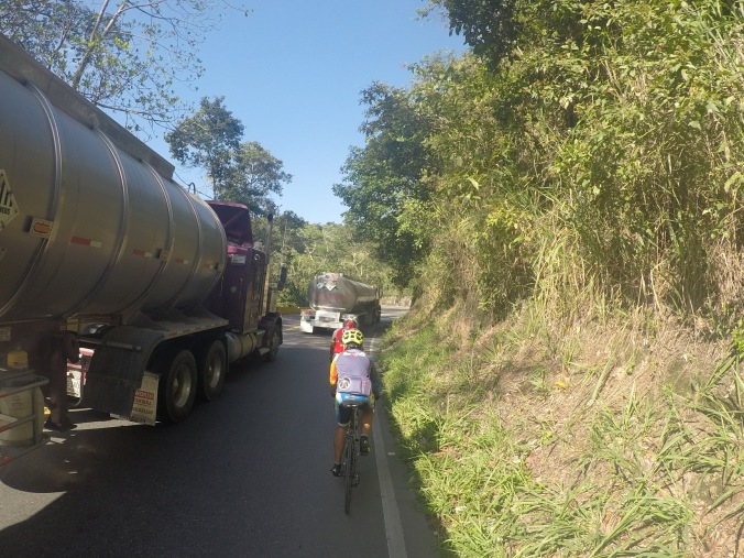
Our last big hill climb in Colombia was celebrated in style by me losing the 2nd of my remaining 9 lives in two days. Already sporting a black eye from my face-meets-rock incident, this time the near miss was with a stray truck wheel hurtling its way downhill towards me. In a surreal slow motion and “ohhh….so this is how I’m gonna die!” moment, I managed to get off the bike just in time to hold it in front of me and make the frame to take the impact. Eye’s closed, I waited for the wheel to bounce up and whack me in the head, but thankfully it hit at an angle and shot off back into the road. Lucky.

IMG_20170409_110046

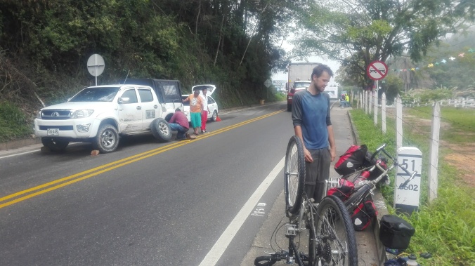
Assessing the damage post impact

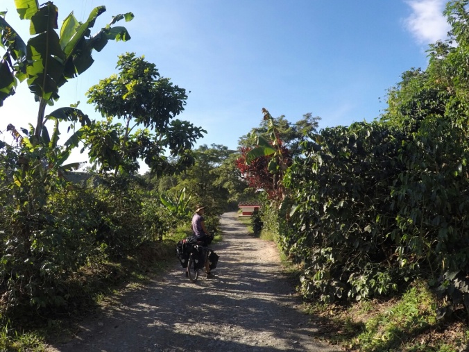
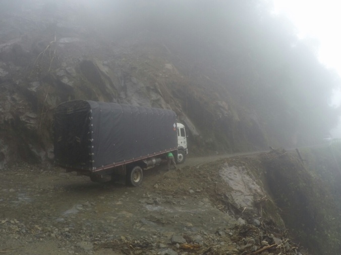
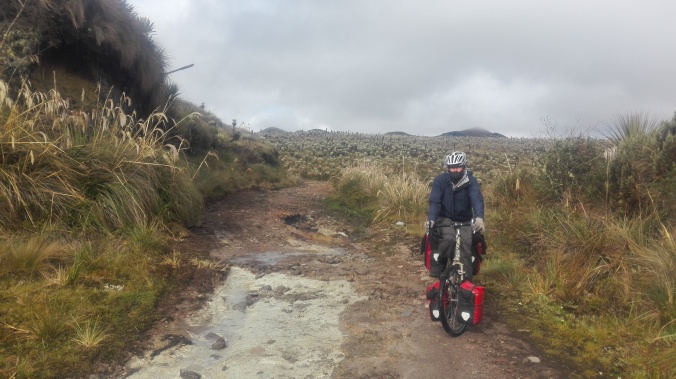
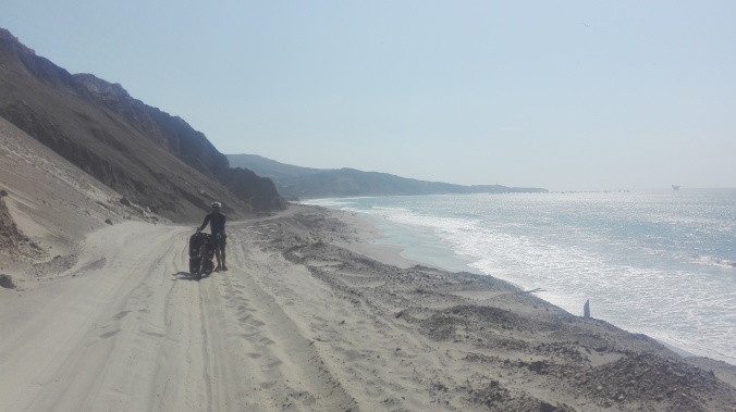
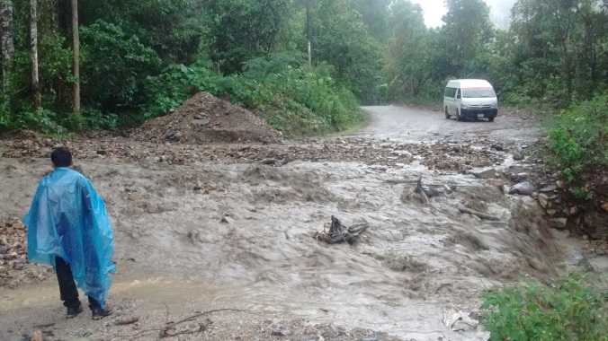
Feeling cursed, we tried to get away from the trucks on the highways and back on to some dirt roads. Mud, rocks, and landslides a plenty….but no cars!

IMG_20170327_113217

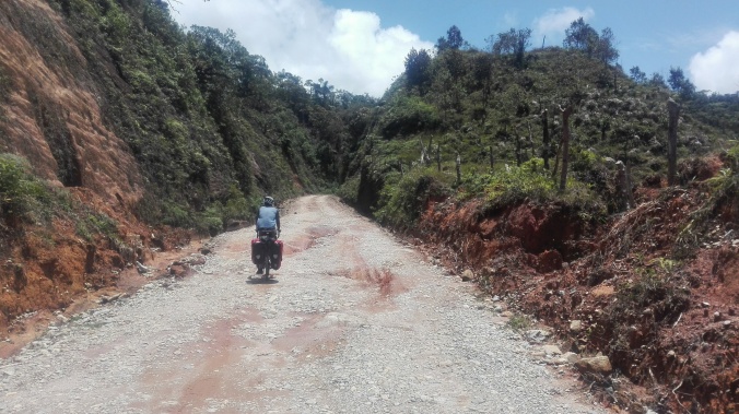
And…relax.  Away from exploding cars and into the mud

IMG_20170409_130427

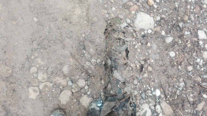
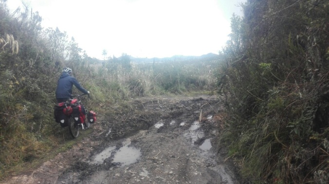
Spot the bike!! My wheel doing a great camoflauge job with the muddy road

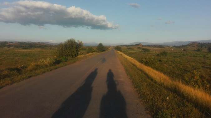
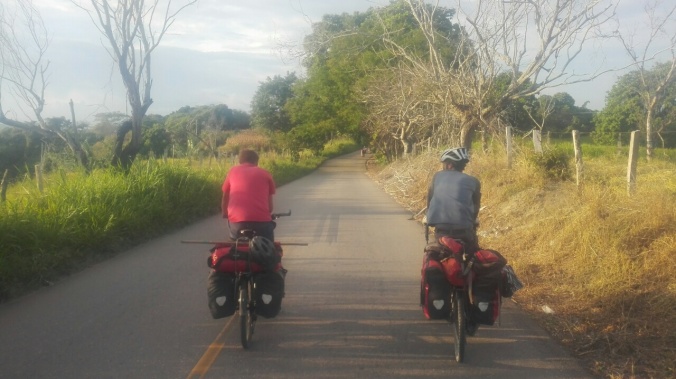
When we finally left the hills behind, it was long, straight, flat, asphalt, stretch through the lowlands to Cartagena. The thermometer hovered around 36 degrees most of the day – a good incentive to cycler faster to create a breeze! The joy of speeding along on the flat after months of constant hills quickly passed and we had to find ways to entertain ourselves….
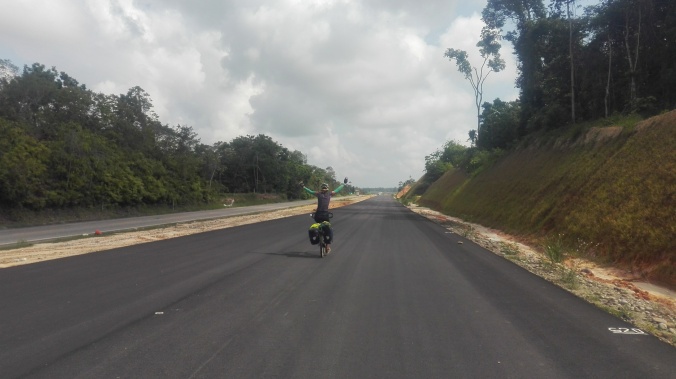
IMG_20170410_091146

Look mum no hands!

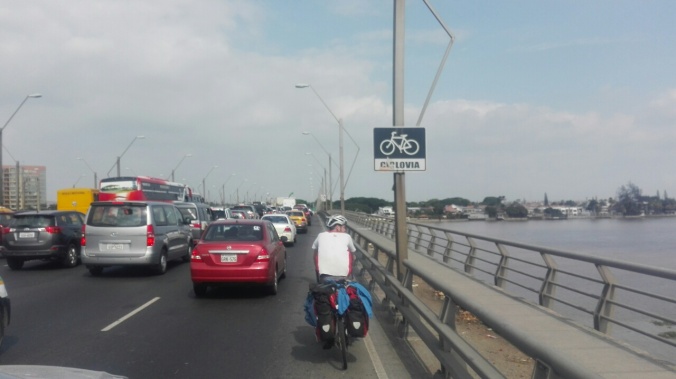
The rush hour traffic in the lowlands was terrible…

IMG_20170411_171022

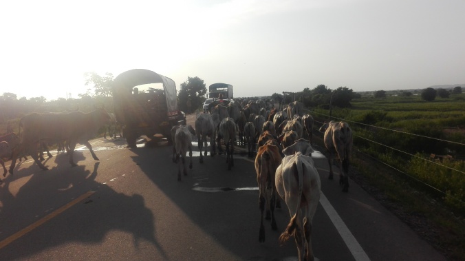
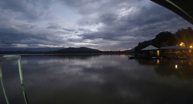
Sunset rush hour on the road to Mompox

….and we made a few friends along the way.

IMG_20170411_151932

Casing a stir whilst filtering our water in a tiny village mear Mompox.  We tried to convince the kids that you put water in one side and squeeze alcohol out of the other

Though it was pretty dull 5 day stretch to the coast, there was one wonderful exception. Mompox! A sweltering, sleepy, beautifully restored colonial era village, sitting on the banks of the Magdelena and packed with churches and plazas. We arrived in the middle of the biggest holiday in Colombia – Semana Santa (Easter Week) to a town buzzing with life. Well, buzzing with life after 5pm. Nobody else was crazy enough to be out in the heat of the day!

A mischievous local threatened to wreak havoc on the annual Mompox floor mural competition. Glittering paw prints last seen heading away from the scene of the crime…

Finally the end was in sight, and we were bound for the coast. A big old river was in the way though, and bridges hadn’t quite reached this little corner of Colombia yet….

DCIM100GOPROGOPR3502.

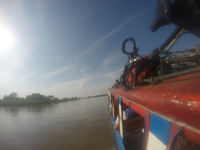
A very nervous ride with our bikes balanced on top of the speed boat to cross the Magdelena

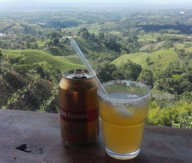
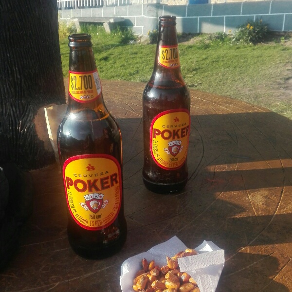
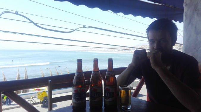
Our last night was spent in fitting style, with a room above a Chinese restaurant on the outskirts of the city, drinking Club Colombia beer and eating salchipapas (the biggest crime against food that has followed us all the way through South America), vallenato music blaring all around. We were happy to spend a final night in true Colombian style before rolling into mega-touristy Cartagena.

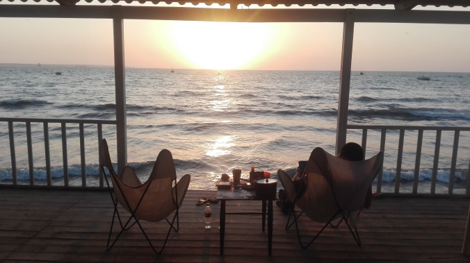
Which we did, the next day, a fantastic last 10km around the 16th century city walls and right up to the Carribean sea. 11 months to the day since we set off from the Atlantic in Rio, the road finally ran out. What a blast it was.

IMG_20170416_101938

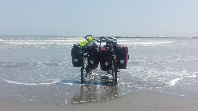
The end of the line – the Surlys enjoying a Carribean dip.

Colombia Part 2 – Broken bodies and visiting buddies

This country has too many roads.  Too many beautiful tarmaced highways, too many  impossibly steep and gorgeous dirt roads, all crisscrossing two mountain ranges with a big, humid valley inbetween. The route choices are endless.  As a result, much of our second leg of Colombia has been spent staring and maps, constantly changing our minds and driving ourselves a little crazy with the options.

But luckily, there is no such thing as a bad choice here.  We’ve opted for a compromise of some dirt, some asphalt, and lots of last minute decisions.  As a result our route across Colombia is starting to resemble a very squiggly line back and forth heading vaguely northward.  7 weeks of riding and we’re not even half way through the country yet!

Leg Two – Ibague to Medellin

Leaving the oppresive heat of the lowlands, our buddy Jonas, and our police station home for the night behind, we headed to Ibague, at that point the biggest Colombian city of our trip so far at that point.  Rubbished by the guide books, we actually loved the hustle and bustle of people everywhere, and managed to find a gem of a hostal in a row of seedy hotels.  Hostal 3rd Avenue was run by a guy who spends half his year driving trucks in the Canada wilderness, and the Canadian winter in his hometown of balmy Ibague.  Winning at life me thinks!

From Ibague, we took on La Linea, a notorious hill climb amongst Colombian cyclists that rises over 2000 metres in 40km or so. Being a beautiful Sunday morning, we shared the road with dozens of lycra clad weekend riders zooming past us, and unfortunately also hundreds of huge trucks

DCIM100GOPROGOPR2940.

Sunday riders and crazy drivers, ploughing up La Linea

The day started well and I was relieved to be feeling strong again after our heat exhaustion.   We cracked out the first 1300 metres of the climb by lunch time, took in some pretty views (ignoring the constant roaing of trucks passing at a hairs breadth) and thought we might actually make the top that day.

DCIM100GOPROGOPR2944.

Views on the way up (and up, and up) La Linea

Sadly, my broken body once again had other thoughts, luckily timed just as we were crawling past the only accomodation option we had seen for miles.

DCIM100GOPROGOPR2950.

There are no words. Awful.

The next 18 hours may have been some of the most comically miserable on the trip, as a nasty stomach bug floored me and we experienced a new winner in the “most horrendous accomodation” race .  Six cupboard-sized rooms conveniantly located under a bar that blasted music until 5am, and a billiards table right above our heads.  The matresses were filthy, the sheets probably had never been introduced to a washing machine, and the owners a frazzled set of misery (probably having not had a good nights sleep in 20 years!).  It was the cheapest placed of our trip, and probably still the worst value.


If ever there was a good enough incentive to recover quickly and get back on the road, this place was it.  We still had 700m of climbing to do and though I felt slightly delerious with dehydration, staying there any longer was not an option! Loaded with Gatorade , we ploughed on.  It was a rough day, but at least we had the road to ourselves thanks to a truck getting itself stuck in one of the tight switchbacks just after our hostal.  The idiotic driver blocked all the traffic for 4 hours, meaning at least I could inch up the hill in peace!

DCIM100GOPROGOPR2956.

Finally getting to the top of La Linea just as the trucks start to come

The destination of Salento was our reward for the tough day, and we found a way to escape the busy highway to spend the last 20km on pretty but tough dirt roads.  I honestly didn’t think I’d make it, and Tom had the pleasure of pushing my bike for me on several stretches.  Hero.

DCIM100GOPROGOPR2964.

Salento was the first real foreign-tourist hot spot we’d been to in Colombia and it’s easy to see why it’s so popular. A beautiful village in the heart of the country’s coffee growing region, full of great restaurants, beautifully restored buildings and gorgeous countryside.  Expensive, but lovely.

Salento

The beautiful restored streets of Salento

Unfortunately, it turned out that we hadn’t quite left the horror of the previous night’s hell hole behind us.  We appeared to have taken a little piece with us, in the form of some kind of infestation in my sleeping bag, which woke me up at 1am with a delighful full body breakout. I itched the night away on a sofa in the campsite’s reception, and as soon as daylight came we quickly abanonded the camping plans, and via a quick trip to the hospital, set ourselves up in a nice room for a few days.

Once the itching had sufficiently subsided, we enojyed the sights of Salento, visiting a Ocasa coffee plantation, and making up for all the terrible tinto we’d been drinking by indulging in lots of real espresso in the town’s cafes.  Colombia is the 3rd largest producer of coffee in the world, producing both “1st class” (the best beans) and “2nd class” (the other stuff) coffee.  It only exports the 1st class stuff, which explains why the country has just a good international reputation for coffee.  The second class stuff is used to make domestic coffee, which explains why the coffee we drink in Colombia day to day is so terrible!

For us, the big draw of Salento was the access point to Los Nevados national park. We started in the Valle de Cocora, a lush valley filled will sky high wax palm trees.

14891709863236.jpg

Camping under the wax palms and full moon of Valle de Cacora

From there, a 2 hour hike took us and hundreds of other day trippers to the hummingbird sanctuary at Acaime

14891711550960.jpg

Hummingbirds feeding at Acaime

From Acaime, only the hardy and/or foolish continue up a further 4 hour climb to above the treeline where the paramo begins.  Full of crazy frailejone trees, and on a clear day, view of the parks volcanoes – Volcan Tolima, Ruiz and Santa Isabel.

14891706879057.jpg

Coming up on to the paramo of Los Nevados

The ramshackle Finca Primavera awaited us at the top of the slog, and we were welcomedwith  cup of hot agua panela (a tooth-rotting but delicious sugar-syrup drink), and paid a few quid to camp and have dinner cooked for us.  A couple of groups doing a guided hike were staying in the dorms there, and we salavated waiting for them to finish dinner before we were allowed to eat! We pitched up under thick cloud with no view, but woke at 6am to clear skies and a gorgeous view of Tolima to one side…

14891717922221.jpg

….and to the other side, the cloud line below us in the valley.

14891706849146.jpg

The clouds set in by late morning, so it was a chilly hike to the hot springs at Termales Canon with it’s huge natural pool full of hot volcanic water. Just us and one other pair there, it was an amazing way to thaw out!

14891706883870.jpg

The volcanic hot pool at Termales Canon.  Pretty special.

Once again, the skies were clearer in the morning and we got a beautiful view of Tolima whilst enjoying the hot springs once again for a morning dip.   The rains soon caught up with us though, and we got a massive soaking and four hours of trudging downhill through knee deep mud the next day as a result.  Just about worth it though!

14891706853787.jpg

Volcan Tolima over the paramo

It had been a rough couple of weeks of body breakdowns (mostly mine…), so from Salento we decided to take it a little easier.  With friends to meet in Medellin in a week, it would have been a tough push to get there by bike.  Instead we we decided to spend time exploring the gorgeous coffee region and to do the last 100 miles or so by bus.  Not a big distance, but a hell of a lot of climbing and energy saved, and a chance for a bit of recovery.

14891706857718.jpg

Enjoying our new relaxed pace with a coffee over looking the valley outside Filandia

We started with a hop to Filandia, a lovely restored town much like Salento but with far fewer tourists, and our favourite plaza of our trip lined with traditional bars and coffee shops spilling onto the street.

Filandia.jpg

Cafe culture in Filandia

Our route to Manizales took in lot’s of rolling green countryside, taking quiet gravel roads through the coffee plantations, with berries turning red and ripe for picking in the upcoming harvesting season.

14891729433673.jpg

Offroad, cycling through the fields of coffee trees.

14891706881998.jpg
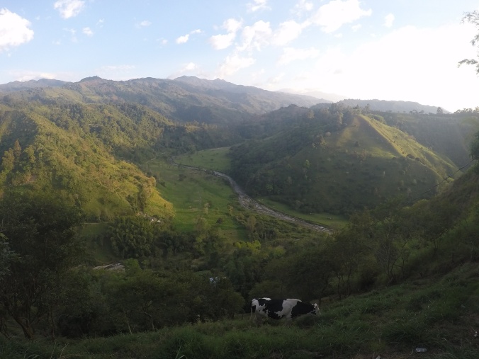
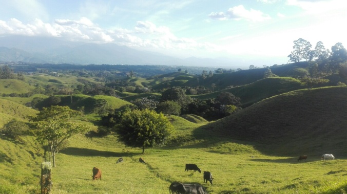
The rolling hills of the coffee region

We spent a day at the hilarious Parque del Cafe, a theme park (very!) loosely based around coffee, with a few rollercoasters and a very camp lunchtime coffee-based musical show.  Much fun.

14891706865722.jpg

Heaven?

Our week of relaxed cycling was perfectly accompanied by glorious blue skied weather, but keeping above 1000m meant none of the humidity of the lowlands.  It was still bloody hot though, and our new sleeping strategy centred on finding hotels with pools that would let us camp for a few quid. Definitely my kind of cycle touring!

14891706871233.jpg

Trying our luck (and suceeding!) camping at a fancy finca

14891729434454.jpg

And again at Finca Venecia near Manizales.  A room for $100 or camping for $10. Win.

Our plan to get a bus from Manizales to Medellin  was almost foiled when we found that only mini buses ply the route, meaning no luggage compartments to put our bikes in.  We had no choice but to almost dismantle the bikes and watch in dismay as various parts where shoved and cajoled into any spare space on the van, greasing the palms of the driver and porter for the pleasure.

IMG_20170221_101333198

Stage 1 of bike dismantling before they got squashed into a minivan

But, 4 nauseating hours later we arived in Medellin with our bikes almost in one piece, and were greeted by a huge strom which trapped us in the bus station for a couple of hours.  An ominous arrival to our new home for the next month, but made all the brighter by the arrival of this one, and his rucksack full of british goodies and finally, after 6 months of futiley searching South America for a pair long enough, a new pair of jeans for me! We spent a brilliant few days with Gabe & Will seeing the sights of the city, before picking up the keys to our Air BnB apartment and settling ourselves in for our month long stay with a Domino’s pizza and a proper cup of British tea.  Wonderful.

DCIM100GOPROGOPR3113.

Buddies reunited! Tom & Gabe


A tribute to Colombian food – the good, the bad and the ugly


Colombia is not a country where you are at risk of going hungry.  Happily for two permanently ravenous cyclists, food is everywhere you look and we’ve found it to be one of the best value countries to fill up in.  Great for our budget, not so great for our waistlines or coronary health…

Every street corner is occupied by open sided bakeries selling cheap-as-chips bread, cakes and coffee from early morning until late at night. Plazas fill with carts selling snacks and tinto, and you’re never far from a deep fat fryer churning out heart attack inducing goodies.

Yes, Colombia does impressively tasteless beige food better than anywhere in the world.   It makes Gregs look Michelin star worthy in comparison, but what the food lacks in taste (and any semblance of nutritional value…), is compensated for by the great culture that comes with it.  Grab a juice and a 10p pastry for in a bakery and watch the world go by, or join the old men at sunset on the plaza’s sipping tinto out of plastic cups and putting the world to rights.  Stand on street corners with business men, construction workers, and school kids and practice the art of eating empanadas one-handed without getting sizzling fat all over you.

Here is a little tour of Colombia via it’s food – the highs, the lows and the guiltily delicious.

The good…

Menu Del Dias

Lunch is the big meal in Colombia, and come midday every restaurant will be serving up a set menu which without fail will include a big plate of rice, beans, fried plantain, a tiny bit of salad and a usually generous slap of meat.  All started with a bowl of soup and washed down with a glass of juice, and usually for less that £3.  Bargain.

img-20170310-wa0006.jpg

A typical menu del dia, perfect fuel for powering up hills.

Fresh, ripe and tasty tropical fruits

All that greenery we’ve been riding through means there is no shortage of delicious, perfectly ripe fruit, always changing as we go through different areas.  Buy whatever grows locally and it will be dirt cheap and delicious.  Mangos, bananas, avocados, watermelon, oranges, chiramoya, guanabana, and our favourite – Maracuya.  A huge, tangy passion fruit delicious in juices.

Tasty fruit juices

Freshly made fruite juices are everywhere, and you are never far from the whizzing of an electric blender making use of all the tropical fruits on hand. Usually loaded with extra sugar and blitzed in a blender with water or milk, they manage to end up being wonderfully unhealthy, but served in a jug with a straw for less than a quid, they are the perfect respite on a hot day of cycling.

14892818619364.jpg

Beer!

The national beer is actually good! Our favourite is the Club Colombia’s Roja (their red ale – they also have a black and a lager), which has been responsible for the recent spike in our alcohol consumption

14891654009408.jpg

Beer with a view

Cracking coffee

Colombia is famous for its wonderful coffee, and whilst most of the good stuff is exported for our Flat Whites at home, the big cities have great coffee shops.

Arepas (about 10% of the time)

Corn or flour patties, grilled on a hot plate and ubiquitous everywhere in Colombia.  Always a gamble, but get them fresh and stuffed with cheese and meat from a street corner hot plate, and they are finger-licking good.

aprepas

If you are lucky enough to find a street side Arepa that looks like this – eat it!!

The “so bad it’s good”…..

Cheese, glorious cheese

Cheese and caramel donut anyone?  How about a stick of cheese to dip in your Hot Chocolate?  Spinkled on your fruite salad??  Colombian’s love cheese and sugar together on just about everything.  We’ve lost count of the number of times we have bitten into an innocent looking cake to be surprised with a chunk of tasteless cheese in the middle, or a cheese bread with sprinkling of sugar on top.

14891654007467.jpg

Cheese and arequipe (caramel) donuts, 15p a pop

Evening street food

Just before dusk, the evening shift takes over with the carts selling buñuelos (fried cheese flavoured dough balls) are replaced by carts grilling up chuzos (sticks of meat), hot dogs and burgers.  Best visited once a few beers have lowered your standards a little, the most popular stall will likely be for a $1 burger or hot dog  loaded with sauce and a generous helping of crisps in the mix.  As a Northerner who often loads my ham sandwich up with a generous helping of Walkers salt and vinegar, I obviously appreciate the addition of crisps to any sandwhich.

street food

Tinto Coffee

This is the coffee that the majority of Colombians drink.  Imagine reusing the soggy grains in your coffee maker 5 or 6 times,  pouring out a shot of the resulting brown liquid and adding 3 teaspoons of sugar.  It tastes terrible, but I love the tinto culture.  Carts ply the streets dishing out thermos flasks full of the stuff, and it’s drunken by everyone regardless of class, job, age.  You can happily sit in a bar or cafe sipping 20p tinto for hours.

14892818618182.jpg

Bandeja Paisa

A traditional meal from the Antioqua region, exact contents vary but expect a gut busting plate of meat, beans, fried pork rinds, eggs, plantain, avocado and a token bit of salad.  Best devoured with a hangover and plenty of chilli sauce.

14891654007086.jpg

Bandeja Paisa. The Colombian equivalent of a Full English, with a tropical twist

Empanadas

Deep fried corn pockets stuffed with rice, potato and meat.  Often left sitting out for hours and impressively tasteless, but just occasionally, a fresh-from-the-frier empanada is the perfect beer snack.

empanadas.jpg

Lurid yellow Empanadas, potentially delicious, probably cold and tasteless.  Who knows!

The downright terrible…..

The other 90%

Yes there are rare times when an empanada or arepa bought hot and fresh on the street are delicious.  But let’s not get too nostalgic….90% of the time they are terrible! Luke warm at best, greasy, and only edible by smothering in a pink sauce which we are assuming is a worryingly tangy mix of tomato sauce and mayonnaise.

Don’t be fooled by the bakeries!

When we first arrived in Colombia, we were giddy at the sight of panaderias packed with all kinds of colourful and oodles of choice of bread.  Sadly, 2 months in I can conclude our thorough research (we’ve worked our way through everything…) and confirm that THEY ALL TASTE THE SAME!!  But we still love the bakeries.  Dirt cheap places to sit, stuff your face and people watch.

bakery 3

Don’t be fooled by the almost Parisian look of some of those pastries…

If in doubt, fry, fry and fry again.

A friend once ordered a side of broccoli in a restaurant,  Guess what?

16649550_10100769264355231_482833598866985898_n


Introducing….Colombia! Part 1: The South

Colombia.  I can’t even begin to do justice to explaining the complex history of this incredible country, even that of the last 20 years, but suffice to say the word “Colombia” conjures up plenty of associations.  Cocaine. Pablo Escobar. The FARC. Gangs. Kidnapping.  I’ll do my best to set the scene a little first…

Whilst at university, I remember a friend telling stories from his summer travels in South America.  He casually mentioned that, whilst in Colombia, his bus had been hijacked by armed men, driven to a field, and the passengers one by one stripped of their belongings at gunpoint. Through the 90’s and 2000’s, the country was a one of the most violent in the world, with Medellin, home to the infamous Pablo Escobar and the city we are calling home for a month, consistently topping the list of the most dangerous cities in the world.  At its peak, there were as many as 400 murders annually per 100,000 people.  This was not a country that tourists visited.

Fast forward to 2017, and Colombia’s President Santos has just received the Nobel Peace Prize for his efforts in progressing a peace agreement with the FARC.  The armed guerilla group had waged a decades old war that has been responsible for killing and displacing tens of thousands of people, and had been a big part of the country’s cocaine business.  Medellin has dropped off the top 50 “Most Dangerous”  list completely, and is now a modern and thriving city, a haven for ex-pats and “digital nomads” (more on that next time…), full of craft beer, shopping malls and expensive gyms.  Tourism is at its highest ever rate, with beautiful towns, hotels, restaurants and plenty of historic sights ready and waiting for the influx of tourists.  Colombia has it all really.  Snow capped mountains, volcanos, deserts, coastlines (the rugged pacific or the white sand beaches of the Caribbean), Amazonian jungle, salsa, music, buzzing modern cities, colonial towns, and the best coffee in the world.  Though there are a handful of places where the gringo trail is firmly established, foreigners are still a welcome novelty in many areas, which has been great for us.  We’ve found people to be welcoming, fun-loving, open, unbelievably hospitable, talkative and eager to help.

To say everything is perfect in colombia in 2017 would be simplistic and very wrong.  The peace deal was controversially passed (after a public referendum vote narrowly rejected it, an amended version was passed by the parliament), and has divided the opinion in the country.   Some see the deal as going too easy on the FARC members and not focusing on the rights of the victims.  For others, the need to move on and look to the future is the priority if recovery is to start.   Drugs and gangs are still a huge problem, and social inequality, gun violence and forced displacement still rage on the background.  Other  rebel groups remain, and in the wake of the FARC departure inevitable violent jostle for their power and control over drugs, land and people begins.

But the feeling of the country being at a turning point is palpable and it’s a fascinating time to be here.  Cyclists we’ve met on our way north have all gushed about how much they loved their time in Colombia, and we were dying to se what all the fuss was about.

It’s been an expectedly tough journey so far, one that has thrown all extremes at us and almost broken us several times.  We’ve had torrential rain, exhausting jungle humidity, 50 degree desert sun, and below freezing nights in the mountains.   We’ve slogged up and down relentless hills covered in all kinds of tropical vegetation, and through shadeless desert tracks punctuated only by the odd cactus.  There’s been heat stroke, hives, bedbugs, days where we have been ravaged by tropical insects, and there has been blood, buckets of sweat, and a few tears.  As I said, its been tough, and eventually 9 months and 10,000km into our trip, my body seems to be saying “no more please”.

Despite all this, it’s fair to see we have fallen in love with Colombia. Though the thought of getting back on the bikes still send a slight shiver down my spine, looking back through the photos of the last 2 months has reminded me what a gorgeous place it is and how much of the country we have yet to see.  Give me another couple of weeks of drinking cappuccinos and craft beer in the city, and topping up on all the British goodies we’vebeen brought, and I’m positive I’ll be dying to get back on the road.

Well, 99% positive!

14888558254954.jpg

Goodies!

Colombia – From the border to Ibague

We crossed into Colombia and ticked off our first tourist sight, Las Lajas sanctuary, a bizarre 20th century faux-gohic church  built into the canyon of the Guáitara River. in homage to an image of the Virgin Mary that miraculously appeared to a peasant girl. Apparently…

14885738324480.jpg

The church at Las Lajas, our first stop in Colombia

We spent the night in a convent and enjoyed the warm evening and toasted to our discovery that everything on this side of the border appeared to be MUCH cheaper than Ecuador.  Hurrah!  Our room cost £3 each, the beers 80p, and our tasty dinner of meat, rice and beans was the £2.50 and substantially bigger and tastier than we’d been used to.  More food? Double hurrah!  Colombia was off to good start.

14883946137930.jpg

More importantly, our first beers in Colombia, enjoyed in the gardens of the church.  Maybe not the best way to ingratiate ourselves with the locals!

Laguna de la Cocha was next via the city of Pasto and some beautiful tarmac roads running through deep gorges with waterfalls cascading through them.  It was our first full day of sharing the road with Colombian drivers, who have now easily jumped to the top of the table of “Worst Drivers in South America”, and after spending most of the last few months at the bottom of my bag, my sexy high-vis vest was back on!

gopr2745.jpg

Beautiful tarmac, plunging gorge, and crazy drivers a plenty on the road to Pasto

At the lake, we bargained a camp-spot in exchange for buying dinner in the restaurant, our lakeside bedroom had the best view in town…

wp-image-2056304823jpg.jpeg

Lakeside accommodation at Laguna de la Cocha

The drizzle and grey of northern Ecuador had followed us, and helped to add to the suspense as we set off to cycle along the fantastically named “Trampoline of Death”.  The only road in the region that crosses the Andes to the lowlands on the other side just happens to be made of mud, and has a nasty reputation for things falling off it.  Trucks, cars, buses…but thankfully no cyclists yet.  Colombia has two mountainous ranges running south to north, with a big valley in between, coast on one side and jungle on the other.  There is no flat option!

Our ride on the El Trampolin de la Muerte  (it sounds even more sinister in Spanish!)  started well, we set off at 7am along a pretty dirt road climbing up to the first of two passes…

14885733984332.jpg

Starting off on the Trampoline of Death.  So far so good.

….but that soon disintegrated into a single lane of mud, dropping off into a deep gorge,  waterfalls flowing over it, and tight blind corners.

14885733984885.jpg

A lorry broken down in a great spot.  Not in picture, 200m drop to the side of the road..

Soon we were heading into the clouds….

14885733994999.jpg

We were popping in and out of the clouds all day, thankfully this part of the road had a crash banister…

….with visibility of about 20 metres, and some unwelcome reminder of how the road gets its nickname.

14885733987537.jpg

.…unlike others! One of many spots along the way where the crash barriers had disappeared into the gully, probably along with a vehicle

A fellow cyclist driving up to the pass (much more sensible…) kept us motivated for the hard climb with some very welcome buscuit donations.

14885733984574.jpg

Free sugar = happy Charlie

We celebrated reaching the top of the second pass with some roadside arepas, and then started the big downhill to the jungle.  The descent turned out to be almost as tough as the climb, with our hands numb from all the breaking, and our bikes taking a battering from the rough road. But,  having been freezing in the rain at lunch time, by dusk we had descended into the jungle, sweaty and exhausted and being bitten by mosquitos.  We pushed on to Mocoa to the sounds of the rainforest, all croaking crickets and cicadas, and the roar of the Rio Mocoa. .

14887417549050.jpg

From the clouds to the lowlands around Mocoa.  Green green green, as far as the eye can see.

14887411408534.jpg


The next few days had us battling, big climbs and alternating extreme heat and torrential rain as we made our way north through the state of Putamayo towards San Augustin.  The state is at the heart of Colombia and the US war on drugs, with 50% of the countries cocoa cultivated there, and despite things being relatively calm when we were there, there was still a visible military presence. Thankfully, the only interactions we had with them were lots of “Hola!”‘s and encouragement, and the unexpected donation of a huge pineapple….

14887410903840-e1488741659384.jpg

Biggest. Pineapple. Ever. Thankfully we were given this at the top of a big hill, and not the bottom!

And so began our introduction to the amazing Colombian hospitality we had heard so much about.  Post-pineapple, for seven days straight, we were (sincerely!) invited to people’s homes to stay,  given pineapples, bananas, cups of coffee, and all sorts of fruits I have never seen before in my life….

One guy, Julian, stopped to talk to us on his moped and offered his house for us to stay (sadly 200km in the wrong direction!).  15 minutes later, he came back after us with a snacks and bottles of water he had bought for us.

14887410922396.jpg

Hero of the day Julian, just before he came back with a bag of goodies for us

Other invitations came from a group of ladies on a plaza in the tiny town of Pital; a student that we were sat uncomfortably close to in a collectivo on the way to the tombs of Tierradentro; owners of a shoe shop in Pitalito and a young couple told us to meet them at their Finca a “few miles down the road”.  Sadly, the “few miles” ahead of were a huge 1000m climb!

Whilst all these offers have been great, and the hostels cheap and plentiful compared to Ecuador, one disappointing thing in Colombia has been the lack of places to wild camp (i.e. find a spot off the road to roll in and pitch up for the evening).  We’ve seen hundreds of beautiful spots but sadly every piece of land is fenced off by rusty barbed wire.  Just once have we managed to sneak off through a hole in the fence.  It was a gorgeous spot though, overlooking a lush valley with the sun setting over hills on the other side.

14887426950680.jpg

Sunset from our only wild camping spot outside of La Plata

The southern half of Colombia is the least visited by tourists, but had plenty of sights for us to hop between. First there were the hidden waterfalls and natural pools of Mocoa, perfect for a swim in the crazy jungle heat….

14887417550932.jpg

Worth the sweaty hour long hike into the jungle – the natural pools at Fin del Mundo

Then came the mysterious pre-Inca sculptures of San Augustin, a pretty town set in gorgeous countryside where we were first held hostage in our tent by a 22 hour storm before upgrading to a lovely cheap hostal. San Augustin was also where I remembered it had been a while since I fell over, and broke the run in style with a bloody collision with a cement paving stone in the architectural park. A nice new knee scar to add to the collection.

Next, Tierradentro another set of ruins a couple of days riding from San Augustin.  This time, a set of tombs strewn across the hills that we scrambled in an out of for  couple of days.

14887410928963.jpg

Tomb Raider Tom at Tierradentro

GOPR2851.JPG

Inside the tombs

Then it was back to the lowlands, swinging by Lago Yaguara just in time to see a gorgeous sunset that we shared with the local police commander, who was determined to show us every photo on his phone of him and his mountain bike.   Yaguara was a gritty but fun weekend town, bars and cafes spilling out on to the streets and soundtracked to the sound of reggaton and exploding dynamite.  Thankfully the explosions were from the locals playing Tejo on a Friday night – lead weights thrown 20 metres into a pit of clay and TNT, all fuelled by beer and the lethal local Aguadiente spirit. Only in Colombia!

14887440684641.jpg

Sunset on Lago Yaguara

14887440685502.jpg

And sunrise

Finally there was the Desierto de Tatacoa, a little slice of desert on the equator.  Sound hot?  Yep!  We rolled in an hour before sunset with our thermometer still reading 100F, but the evening shadows were beautiful.

14888133352240.jpg

On the way to Desierto de Tataco after one of the hottest days I’ve ever experienced on the bike


14888133353962.jpg

Squeezing in one picture of the desert before we retreated back to the air con!

Fragile but mostly mended, on day 3 we reluctantly headed back out in to the desert heat, this time at 7am. A gorgeous ride through cactus lined trails, through crazy tunnels and tracks through plantations kept our spirits high despite it being horrendously hot by 9am.

14888133349729.jpg

We picked up a cycling buddy in the form of Jonas, 3 years into his bicycle meanderings across the world, and still with a great spirit for the simplicity of travel by bike. He was camping in local’s gardens most nights, travelling cheap and always taking the scenic (i.e. hard!) route.

14888533664582.jpg

Tom & Jonas, cycling on to Payande after a 2 hour cool-down siesta and swim in the river

Whilst Jonas pushed on to find a free campspot, we finished our time in the lowlands in style, accidentally spending the night on the roof of a police station in Payande after finding the only accommodation in town full.  Once we had convinced them that we weren’t carrying drugs or bombs (the result of a a very thorough bag search!) the big smiles came out, and the police guys at the station were incredibly hospitable  We passed up the private bedroom we were offered in favour of the cool air of the rooftop outside it.  With the stars sparkling above and a light breeze staving off the humid air, it was easily the best nights sleep we had in a while.

14888533668483.jpg

Home for the night, police station in Payande

Ecuador – The bit before Colombia

I sat down to catch up on the blog, and to fill in the gap from of the couple of weeks we spent in Northern Ecuador, and our journey through Colombia to Medellin, where we are now. The city will be our temporary home for a month, a place to recharge, decide what we want to do next and take some spanish lessons tomorrow.  Better late than never!  But looking back through photo’s of Colombia, there is far too much to squeeze in – deserts, jungles, mountains, the discovery of cheese donuts, and a road reassuringly called “the trampoline of death”.  So to do it justice, all that can wait until next time.  For now, here are the last few weeks of our time in Ecuador.  Please excuse the terrible photos – rain, grey skies and fear of breaking another camera by dropping it in a puddle do not make for great snaps!

Quito didn’t want us to leave, as much as we didn’t want to leave it.  So much so that we only made it two miles after our farewells to Fernando & Andrea before the skies above the city angrily unleashed one of the most momentous thunderstorms I have ever seen.

Luckily we just happened to be next to a cheap hotel, which just so happened to be next to a Scottish bar, which just happened to be in the middle of happy hour on pints of not-too-shabby IPA .  We took it as a sign and made ourselves comfortable, putting off our return to the bikes for one more night.

img_20170103_182217.jpg

Our second attempt at leaving Quito was more successful (albeit accompanied by a slightly fuzzy head), and we were bound for the equator!  For a capital city the route out was relatively unsketchy, through the wealthy suburbs and soon on to a beautiful 20 mile car-free cycle way following a disused railway line.

img_20170105_100426.jpg

Turning on to the ciclo-via.  Great facilities all the way, free water, toilets and showes.

It felt like an episode of The Hills at times, manicured mansions on each side, clear blue skies and lycra clad ladies of leisure power walking along the trail with their toy dogs. It wasn’t long before the scenery was once again lush and green, as the old tracks curved up an around the hills around the city, crossing river valleys, and through tunnels carved through the steep slopes and gradually the homes of the rich and the famous were swapped for small farmers fields and soon we were back in the proper Ecuadorian countryside. Not having had much sun in Ecuador, we were surprise how hot it quickly got when the early morning shade disappeared and by lunch time, we were both turning a nice shade of pink as we slogged up a dirt road in the midday sun.

img_20170105_105459.jpg

Following the path of the old railway line away from Quito, the city quickly felt very far away

But, we got the opportunity to cool off a little sooner than we’d hoped for.  From being frazzled and sunburnt one minute we were soon huddled with numb hands and feet over hot coffee when the skies suddenly turned grey again and unleashed a torrential downpour on us.  It turns out we had left the run of lovely weather behind in Quito, and the next couple of weeks would fall in to a similar pattern of gorgeous mornings and sweaty climbs, followed by sudden afternoon soakings.  My trusty blue pound shop poncho would be making a regular appearance…

We hit the equator (which felt distinctly un-equatory and more like a cloudy day in Yorkshire), and got ready to pose with the iconic equator line.  All day I’d been dreaming up “hilarious” poses for photos.  Once foot on each side? Brilliant. One wheel on each side? Genius!  But we couldn’t for the life of us find the famous equator line carved into the road.  Just a rather anti-climactic plastic sun-dial that an enterprising local had erected for groups of confused tourists who must have thought they were heading to the much more professional statues on the other road (oops).  Given the complete absence of sun, and the $5 entry fee, we gave the sun-dial a miss and sneakily posed for photos before being chased away.  Despite the grey skies, and very british looking stone wall, you’ll have to trust me that we are in fact in the tropics, and not the lake district here!

img_20170106_101748.jpg

The equator, honest.

img_20170106_101552.jpg

(See confused day trippers and sun dial in background)

We’d set of from the comfort of Quito determined to get back to camping as much as possible, and though the days earlier rain had been a test of our will power, we had persevered! We decided to try our luck camping at some thermal springs that we’d heard about nearby and were in luck, pointed towards a playground where we could pitch up.  A free nights camping by a raging river, and a 6am visit to a steaming hot pool  was a great end to our first day back on the road.

14876257515894.jpg

Home for he night.  Taken just before I whacked my head on the swing frame (sadly without helmet)

14876257514783.jpg

Off for  morning dip at the equator hot springs

Otavalo was the next stop, a highland town famous for its indigenous market to which locals from surrounding villages flock to on Saturdays to buy and sell everything from cows (alive and otherwise…) to shoelaces. The market sprawls on a weekend, with people taking up every available inch of concrete on the town’s streets, often just selling a few bits of fruit or veg that they have grown.  But the main action centres on a muddy field which reminded me from a distance of a car boot sale in Warrington.

img_20170107_091007.jpg

Otavalo animal market sitting, overlooked by Imbabura Volcano

otavalo-animal-market-3

Ladies in full traditional dress held up guinea pigs for thorough inspection by prospective customers, an expensive purchase for lunch at special event at a wedding or fiesta. In the miles leading up to the market, we saw obedient pigs and cows walked along the highway by rope, probably ending a journey that started very early that morning from a village in the hills. Cattle and horses were noisily bartered for in the pens, whilst in between the mud and faeces were stalls selling “traditional handicrafts” (probably “traditionally” made in China…) to tourists on day trips from Quito.   The change in faces, dress, and language (switching from Spanish to traditional Kech-wa) was dramatic after cosmopolitan Quito, but having spent 3 months in highland Peru felt nicely familiar.

otavalo-animal-market-2

Admission – not my photo! But sums up the animal market pretty well.  

A side trip to Lake Mojanda had us crawling through marshes, jungle, bog and mud following an “easy” hiking trail around the lake that we both swear we’d read about and could see as a usually reliable dotted line on our Maps.Me app.   It started well, with a great view from Volcan Fuya Fuya (well, for at least the 5 seconds that the clouds cleared and we managed to snap a pic!)…

14876257542439.jpg

One of our standard “great views” from a peak! Lake Mojanda in the background somewhere

14876257545971.jpg

Ah, there it is

…but soon the “trail” disappeared and a thunderstorm, some too-close-for-comfort lightening, and a few hours of torrential rain were thrown in for good measure.  8 hours later we emerged bedgraggled from a dense patch of forest to the park rangers hut who looked slightly surprised to see us.

14876257546602.jpg

Out for a lovely stroll

They bemused rangers helped us to thaw out with several cups of sugary coffee, and kept saying something about our tent that we didn’t quite understand, so we did our usual nodding and agreeing act.  Turns out they were trying to tell us that our tent was now an island in a newly formed lake….

15937184_10154937221342628_5160768393907104761_o-2

Newly formed Isla de Tent. 

Somehow our stuff was was relatively unscathed, and thanks to Ecuador scrapping all fees for their national parks system in recent years, it was at least a cheap few days!

Back in Otavalo, our poor hostel was temporarily turned into a laundrette as we covered every available space with our soaking possessions, then we were finally bound for Colombia! We finished our month in Ecuador in style with some tough dirt road riding up to the remote El Angel Bio reserve, a unique “paramo” landscape filled with crazy 7 foot high Frailejones plants that suddenly cover every piece of earth as you get up to 3300m.

14876284257230.jpg

Frailejone plants at El Angel reserve – making the most of a break in the rain to take a few snaps

Reaching a lone rangers cabin at the top just as the daily downpour started, we were mortified to be told that the campsite we were aiming for didn’t exist, and with steep hills all around there was no way we’d be able to wild camp.

But soon we were sending praises to the government again as we were ushered inside and shown to a room with bunk beds, mattresses, and a kitchen and told we were welcome to stay for free.  “Es para las turistas…todo gratis”.  Bingo!  We spent the afternoon hiding from the rain and the fog that had now engulfed the hut, with cups of hot chocolate, and entertaining the presumably very bored park ranger who spends half of his life up in the clouds.

Our last day in Ecuador was an eventful one. Waking up at almost 4000m, the clouds still hugging the hills, we asked our ranger friend about the road ahead. He pulled a disgusted face and said the words “malo” (bad), “terrible” and “agua” a lot, and started to do an impression of what looked like a biker riding down a staircase.  Perfect.

img_20170112_081901.jpg

And the prize for Worst Road of the Trip goes to….

Off we went, and we soon realised his impressions were very accurate.  The road was horrendous, alternating mud, boulders and what can only be described as small lakes blocking the way, all helped along by the previous days downpour.  It was pretty fun though, spurred on by knowing there was a huge tarmac downhill waiting for us eventually. It took us about 3 hours to do the 15km DOWNHILL obstacle course, shoes often abandoned, along with any attempts at staying clean.

14876284257721.jpg

Just a bit of mud

We emerged filthy in the border town of Tulcan, after rolling down through green hedge lined hills full of cows that reminded us of England in the early summer, and squeezed in our last, and possibly most bizzare tourist attraction in Ecuador.  A huge cemetery, filled with over 300 elaborately carved cypress trees in the shape of parrots, inca gods, and all manner of other inappropriate things.

tulcan2

Another stolen photo, this one of the carved trees at Tulcan cemetery

I do have a strange fascination with foreign cemeteries, especially those in South America which are often beautifully cared for, colourful, and very much places of life and tranquillity.  Not for them the grey marble and dourness of home, but graves stacked above ground, brightly painted and decorated with flowers.

img_20170112_120439.jpg

South American cemeteries are always strangely beautiful

But even I admit, this one is bizzare!

img_20170112_120720.jpg

Parrot/graves

After a bit of grave spotting, we arrived at the Colombian border which can only be described as mayhem, and we wondered whether it’s contrast with the modern and efficient Ecuadorian one was any indication of what was ahead of us.  A couple of hours later, we had our 7th set of immigration stamps in our passport and had changed our last dollars with a man holding a wad of cash so large he needed two hands to hold it.  We were in Colombia!

14875415423413.jpg

Peru to Ecuador – via beaches, volcanoes and a 35 degree Christmas

Since we left the highlands of Peru for its sun drenched coast, the proportion of our time spent on two wheels has definitely taken a nose dive. A combination of the good weather, hammock filled hostels, big cities and tourist towns full of the familiarities of home has kept us lingering in places longer than we had planned.  We had a blast in Lima, living a life of luxury for a few days (thanks to some saved up hotel points and some liberal use of the credit card!), and enjoyed a few days being beach bums in Mancora.  After exactly 93 days in Peru, we then crossed into Ecuador, revelling in the newness of our 6th country and a new chapter in our Lonely Planet guide-book.   But (and apologies for the #FirstWorldProblems here!) we’ve also found a bit of a travel lethargy creeping in.  Yikes!

Travelling slowly, and getting to know a region or a country well is a lovely way travel.  At 10 mph from the saddle of a bicycle, you notice every subtle change in the landscape, the characteristics of the people, and how they all link together.  Half a year in though, it does inevitably mean that day-to-day, we are less likely to see and experience completely new things.  And what happens when things start to become familiar and routine?  Time starts to pass QUICKLY!

So, we are now in Version 2.0 of our trip, the part where we try to stop it flying by without us noticing. Our plan is to keep ourselves moving and busy, to ween ourselves off the comforts of the last month, and to get back to the simplicity of back road travel and camping. And, to start planning for Colombia! A country we’ve heard nothing but amazing things about, and where we might find a place to call home for a while.

But before Colombia, there was the last few hundred miles of coastal Peru and the small matter of a whole new country to get through.  Here are some of the highlights of our last 6 weeks saying a fond farewell to Peru and hello to Ecuador.

Peru – Trujillo to Tumbes

After our extravagant side trip to Lima from Truijillo (on a bus with seats more comfortable than most beds we’ve slept in on the trip),  we returned to the north coast at Piura, few hundred km further up.  The leapfrog allowed us to skip a region with bit of a reputation for bike muggings at gun point (nice), and to make up some days on the rapidly expiring visa. Stepping off the bus at midday the dry heat of the desert was like walking into a hair dryer, and it was an unforgiving couple of days riding along in the intense sun on the flat (woop!), tarmaced (yes!) but pretty dull (boo!) pan american highway that dragged on for miles.

DCIM100GOPROGOPR2243.

Sand, sun and shadows along the Pan American.

Though the riding was pretty dull, the destinations each day were idyllic – beach villages along the coast, where the sound of the waves crashing replaced the usually chorus of dogs barking as our nightly lullaby.  First there was Colan, with its gorgeous beach lined by house on stilts, where the tide literally came in under the floor of our bedroom at night. Then came the surf town of Lobitos,  and then Cabo Blanco, once a place of legend amongst fishermen and where Ernest Hemingway reportedly lived whilst writing The Old Man & The Sea.  Finally there was the marmite-town of Mancora, a little piece of backpacker heaven or hell, (depending on your feelings towards dreadlocked jewellery makers and music blaring until 5am every night).

14832997624971.jpg

Beautiful beach at Colan, lined by house on stilts

img_20161121_135136.jpg

Enjoying our first beach side beers in Huanchaco, just north of Trujillo

img_20161128_180845.jpg

Sunset drinks on our balcony in Colan, the tide coming in underneath us.  Magical.

Where we could, we went searching for the back roads that would take us closer to the sea that was hidden out of view from the highway.  Between Colan and Mancora we found them, and the views were spectacular, skirting right along the pacific coast along mining roads.  Beautiful, but bloody hard work!

img_20161130_150019.jpg

Scenic, but completely unridable in places with our heavy bikes.  Sand is just not as fun when you’re not lounging on it with a cocktail

img_20161130_121244.jpg

Mining roads carving through the desert next to the coast

Leaving the hammocks and dreams of becoming a 31 year old surfer chick behind in Mancora, we were bound for Ecuador a couple of days riding away.  We enjoyed our 92nd and final evening in Peru on a balmy coastal plaza in Zorritos, amongst the locals enjoying the cool of dusk.  Our last pesos were spent on a couple of cold Cusquenas beer, some delicious street food, and what we feared might be the last Sublime chocolate bar of our trip for dessert.

Just before the border, we hit the 5000 mile mark of our trip,  which after 200 days of riding gives us an impressively low average mileage of 25 miles a day! Yes, we could probably be in the USA by now if it wasn’t for all the hiking/eating/hammock swinging….but where’s the fun in that!

DCIM100GOPROGOPR2287.
Hitting the 5000 mile mark just before Tumbes, the last town in Peru
DCIM100GOPROGOPR2289.

And then entering our 6th country!

Ecuador

Our first target in Ecuador was the big city of Guayaquil, where we had a bed waiting for us for a few nights through the cyclists couchsurfing website Warmshowers.  It was a sweaty 3 days through miles and miles of banana plantations – surprisingly green and lush, despite us only a few hours earlier being in the arid desert of Northern Peru. More uninspiring riding on the Pan Am, but it was fast, and the novelty of getting into the groove of a new country, its customs and quirks, and (of course!) what new food was on offer kept us entertained.    First impressions were good, friendly people, good fresh food and MEAT! Actual meat cooking on bbq grills everywhere, not just the fried chicken and unidentifiable cuts served up with the almuerzos of Peru.    Oh and really big bananas….

img_20161207_125659.jpg

Having a chat with the locals at 13 mph

Getting to know the local cuisine – Fritada (piles of pork, plantain and corn), ceviche, hornada (hot suckling pig, yum), arapes (corn bread in banana leaf)and good old meat-on-stick.

Riding into Guayaquil, teh biggest city in Ecuador,  was an experience in survival and self-preservation, with a comedic set of cycle ways that deposited us in the middle of a 6 lane highway every now and then.  Like cycling on the M25 at rush hour, with an added dose of latino driving skills and 40 degree heat.

14830576748690.jpg

Riding along the cycle lanes/6 lane motorways of Guayaquil

But survive we did, and the next day we found ourselves stars of a film being made by our hosts to promote cycling in the city.  Cristian and his friends are determined to set up a city bike tour for tourists, and needed to recruit some willing gringos to test their route on and film for their promo video.  We spent the day on our bikes seeing the sights of Guayaquil, which in a city with so little cycling infrastructure meant lots of mounting pavements, riding the wrong way down one way traffic rammed streets, and zig zagging between buses.  Their route might need a bit of tweaking to suit your average transit tourist en route to the Galapagos, but it was great to spend time with a bunch of people so motivated to enact change in their city.

Famous at last. Promo pics for Iguana Bike Tours in Guayaquil

We also got our first taste of Christmas in the city, posing for photos with santa, as well as the local Iguana population in a 99% humidity that killed us off by lunch time. The festive warm up just wasn’t the same without freezing cold and Mariah Carey crooning eveywhere we went!

Getting festive and meeting the local Iguanas

From Guayaquil, we had a choice of routes that would take us to the capital of Quito in the North East of the country.  Either extend our beachy meanderings for a little longer and follow the coast (the long but flatter route, with great tanning potential!), or get starting climbing back into the hills and follow the spine of them north (the shorter but hilly, and probably grey and rainy route).  We’d decided on the first, and it was only by accident that I was reminded that there was a terrible earthquake on the North Coast of Ecuador earlier this year. Many of the beach towns we’d planned to hop along had been all but destroyed, and whole communities were still living out of tents.  So, the mountains it was. Which meant starting with a little 4000m climb from sea level….

It was a slog.  We discovered that Ecuador doesn’t opt for the long and gentle switchbacks of Peru, instead preferring the “straight up and over” approach! It took 3 days of grinding away in our lowest gear, dodging the grey clouds, and an accidental stay in a “love motel” (only realising when we collapsed on the bed to see a ceiling wide mirror above us, honest), but we made it up and over the hills to Banos.  Our biggest non stop climb of the trip, and a nice gentle reintroduction to the hills after a stretch of flat riding.

img_20161211_152741.jpg

The lush green hills of southern Ecuador suddenly cloaked up grey cloud rushing up the valley

It was more time off the bikes in Banos, where our travel lethargy crisis hit its worst.  Ecuador’s “outdoor capital”, which has every activity on offer you can think of – river rafting, rappelling, mountain biking, canyoning.  But mostly we ate donuts and drank a lot of coffee, and took a side trip to pretty Cuenca where we ate more donuts and drank a lot of beer.  We did manage to get off our arses long enough to go on a suicidal swing over “the edge of the world” though!


The swing at the edge of the world over Banos.

Colonial Cuenca

Newly motivated with our “Version 2.0” trip principles, we left Banos by the backroads towards Coatapxi national park.  All set to get some big miles and big climbing done, my digestive system had other ideas and an emergency hitch hike was very necessary.  Thankfully, Jesus came to our rescue. Yep, Jesus Robalino, who turned out to speak great english with a brilliant cockney/Italian accent having spent the last 15 years working in a pizza restaurant in Covent Garden, was the first guy to stop, and might be one of the nicest men we’ve ever met.  He drove us past his destination to the next town 20km on, and dropped us at a hotel with promises that we’d all meet up next time he was in London for a kebab. Our hero.

DCIM100GOPROGOPR2401.

Disappointed to be hitching, secretly a little bit happy as we zoom up a 1000m climb in 15 minutes rather than 4 hours!

DCIM100GOPROGOPR2406.

Our hero Jesus, Ecuador’s best cockney pizza chef

A quick recovery and we were onto Coatapxi National Park. Finally, we saw some of the incredible volcanoes we had been riding alongside for the last couple of weeks, but that had been hidden behind the low clouds that had become the daily norm.  Having set up camp under the usual grey skies, the next morning we woke to a clear blue sky and the beautiful snow capped peak of the smoking Coatapaxi volcano, with 6 more glistening on the distant horizon.

14830576730113.jpg

Smoking Coatapaxi under the first blue skie of the Ecuadorian highlands.  The view from our campsite

We were incredibly lucky – others (a man who had walked there from Argentina, no less) told us theu had been there for days and seen nothing but rain and cloud hiding the volcano.  We spent a day hiking around the park and enjoying the great free campsite,  and  set off on a gorgeous ride out of the park the next day towards Quito feeling re-energised about cycling after a bumpy couple of weeks.


14830576858718.jpg

Leaving the campsite for Quito

14830576807121.jpg

Heading past the Coatapaxi volcano with a big grin on my face

img_20161222_113230.jpg

Goregous riding continues, with cobbled roads through countryside that looks like England in the summer.

Our crew of 2 become 3 for a few days, as we picked up a mascot in the form of a gorgeous little dog at the park entrance.  He jogged alongside us the 15km to the campsite, kept us company for 2 days and followed us 20km more out of the park until our down hill pace finally got the better of him. Apparently she is the park pet, adopting cyclists and hikers for a few days.at a time as they pass through and living the life of Riley chasing horses, lamas and cows when her companions are cycling too slowly.  She was the perfect antidote to all the chasing and barking we’ve endured on the trip so far and I must admit I felt a little betrayed when she finally left us for some hikers heading in the other direction! Hussy.

A homage to our little canine buddy

Coatapxi was definitely the highlight of our time in Ecuador so far and a wonderful last day riding before more time off the bikes for Christmas at the beach (burgers, beer, and ice cream for lunch) and New year in Quito.  Which is where we are now – recovering from our New Years eve hangovers and house sitting for a week for a lovely familu we met through Warmshowers.  Another example of the incredible generosity we’ve had shown to us on the trip.  It’s been nice playing house for a while, having such luxurious things as a couch, a microwave, and a table to eat our meals at.    We like Quito a lot, but are ready to get moving again.  Next stop…..Colombia!

img_20170103_182217.jpg

Fernando, Andrea and little Samuel scoffing a burrito in Quito


Realising mountains are quite difficult to cycle over – 3 weeks of crisscrossing the Peruvian Andes

I’m writing this from the 17th floor rooftop pool of a hotel in Lima, celebrating 6 months to the day since we pushed off from Ipanema Beach in Rio de Janiero.  There’s a family from Yorkshire occupying the sun loungers next to us, and filling my ears with a gorgeous familiar drawl that makes me slightly homesick in a nice way.  I have (my 3rd) gin and tonic in my hand, and the sun is setting over the Pacific in front of us.  Life is good

The last month of crawling through the mountains and dodging snow storms now seems like a world away, but looking back at the elevation profile from my little GPS tracker brings screaming back every thigh busting high and bone shaking low of the last stage of our highland adventures.   It also makes me think back to a year ago when I had to dismount and push my bike over the biggest hill that Southern England when attempting to cycle from Brighton over Ditchling Beacon (a mighty 248 metres)!

great-divide-2

Very technical diagram which basically shows “we climbed lots of massive hills and it was really hard!”

With the exception of our jungle detour, we’ve been above 3000m now for well over 3 months, and it was all leading up to this part of our trip – the real Peruvian Andes. The Cordilleras. No more foothills, no more flat stretches, just one gravelly mountain pass after another that took us a thousand slow kilometersfrom from Ayacucho to Huaraz, where we spent another couple of weeks in our hiking boots .  There were daily 1000m+ climbs, descents that sent me flying off my bike, beautiful wilderness and wild camping spots that made us feel like we were the only people for miles around. It was gorgeous, and it was fricking hard. So I think I will pour a 4th G&T whilst I remnisce….

We’d planned to follow the Andes by Bike – Great Divide route, but ended up doing lots of on the fly route changes, to dodge the army of orange Peruvian road builders who are tarmacing Peru’s dirt roads at a rate of knots. A endless gathering of workers lining the roadside never failed to “entertain” us as we slogged up hill, with their “gringooooooo!!!!” . All meant in good jest but SO much harder to respond to in good humour when you are crawling past people at 6kph.  MUCH more fun when you are zooming downhill past them.

14766640862692.jpg

On your marks…get…set…..GO. Leaving Huancavelica and a few days of racing the tipper trucks trying to tarmac the road

Mostly, our routes choices turned out to be awesome, a mix of tarmac and lots of peaceful dirt roads lined with dozens of lakes, mountain views, unexpected hot springs to soak our road worn bodies, and friendly villages.  We started to enjoy looking at the map and purposefully trying to find different ways to head north.

We headed hrough river valleys where the only locals left in deserted villages were donkeys grazing in the sun…

14772498939640.jpg

Leaving the tarmac after La Oroya and following the river


14772498937419.jpg

A lonely donkey and a deserted village


…around dozens of lakes of all kinds of colours…

14772498926073.jpg

A last minute change of route from La Oroya proves to be a success as we spend the morning skirting around a huge lake

14777517426013.jpg

…and over dramatic mountain passes, each one revealing a completely differnt landcape on the otherside….

14772498908748.jpg

The reward for climbing up to 4700m, ready to zoom down to Picoy, and trying to beat the grey clouds on the horizon (we lost)

14777517399320.jpg

Our first view of the Cordillera Huayhuash climbing towards the Raura mine, including a huge glacier hanging between the mountains

14772498949285.jpg

Ummm….can’t remember where this was! But it looks pretty

We found some great wild camping spots, by glacial lakes, pink rivers and overlooked by snowy peaks….

14777517459922.jpg

Camping at 4600m on the Pastouri Highway.  After hiding under our tarpauline at the side of the road for a couple of hours the skys cleared to reveal a huge glacier behind us and a pink river running down from it


…including one where we unexpectadly woke up to this view, after pitching our tent in the near dark of a rainy, cloud covered dusk.

14777517463367.jpg

Camp spot after desending in the rain through a mining camp at Raura

14777517441493.jpg

And another gorgeous lake that was waiting for us just around the corner

There were also some not-so great sleeping spots, including a patch of grass that turned out to be mostly made of cow poo, and some impressively awful towns and villages.

14766640880678.jpg

Another day, another beautiful highland village.  This one was Acostambo, which seemed to consist of one muddy street, a handful of roadside shops, and a lone horse wandering freely around.

Highlights  of awfullness included Rapaz, where our only sleeping option appeared to be a bed shared with the elderly (ancient) owner of the full hospedaje (for a fairly hefty fee!), in a room that smelt like it had been no stranger to death.  Then there was Oyon, home to an unusually high number of unfriendly locals, and where we ended up in several heated arguements with shopkeepers, hotel owners, and random people on the street calling us gringos.

But mostly, and especially away from the more well trodden villages on the Andes by Bike route,  “Giant” Tom and his facial hair continued to prove a hit with the locals…

…and we continued to scare the sh*t out of sheep all over the country

Our mornings were generally blue and brights, but rainy season loomed with some menacing grey clouds starting to gather by early afternoon.  Mostly we were lucky, and the clouds passed us by or we managed to take shelter in random villages, or get our tent up before the late afternoon rain started.

14772498942373.jpg

Good timing, tent up and brew on shortly before the downpour began

…but a few times we were caught out.  Time to engage poncho, industrial rubber gloves, and commence the failproof tactic of “hide under taurpauin for 2 hours”.

At Abra Rapaz, we hit out highest point yet on the bikes, a breathless 4965m, and achingly close to 5000m mark…

14772498915329.jpg14772498919020.jpg

….and hit an unexpected low when we a we took a “short cut” only to accidently descend 2500m .  Knowing we’d have to slog back up to get back to where we wanted to be (every 10 seconds of downhill fill, is at LEAST a minute of pain to get back up again!), sometimes, you just have to lie at the side of the road and pretend to be on a beach instead.


img_20161012_105521278

Legs say No


In the bigger towns and cities along the way, we continued to find time to work our way through our Peruvian, trying our first, then second (and safe to say, last) guinea pig, awesome Ceviche in Huancayo.  But mostly we continued to eat a lot of pollo a la brasa (chicken and chips) and

Signs in Huancayo and Huancavaleca entertained the teenage boy’s sense of humour in us as the referenced the traditional “Huanka” culture, and one restaurant name that we have no excuse for!

We arrived in Huaraz, feeling like conquerers of the Andes!  1000 kilometers, 21,500 metres of climbing and 10 or so moumtain passes cracked through in 18 days.

14800986340650.jpg

The “look mum no hands” celebration on arriving in Huaraz

But we’d really only just gotten started.  A few days  later we were off in to the mountains proper, donning the rucksacks again for an 8 day walk around the incredible wilderness of the Huayhuash circuit, then the 4 day Santa Cruz trek.  A perfect end to our time in the highlands, where the weather rewarded our previous few weeks of graft with an unseasonal week of glorious weather and blue skies. After weeks of glimpses and far off views, we finally saw the the mountains in all their close up, sun drenched glory.  Amazing.

A few photos from Santa Cruz…

and a few from Huayhuash…

Finally ready to say goodbye to the mountains and dirt roads for a while, from Huaraz it was a dusty few days down to the coast where we joined up with the big old Pan American highway, ploughing north through the desert.  A complete change of scenery, but we’re looking forward to a few more gorgeous sunsets now as we head up towards Ecuador with the Pacific to our left.  First though, a few days in Lima (via bus!) where we shall be mostly lying by a pool, drinking pisco sours, and blowing more cash than we’e probably spent in a month on a single dinner at the world’s “13th best restaurant” Maido. Bring it on!

14803003582620.jpg


A jungley detour – Cusco to Ayacucho via the Narco lands

Back from our hiking sojourns around Cusco, and fattened up again after a few more days of post-hike indulgence, we couldn’t put it off any longer.  It was time to get back on the bikes and start heading North!

There wasn’t an obvioulsy appealing route out of the city, and most south bound cyclists we met in our hostel had arrived by bus to skip the hilly slog along a main road from Ayacucho.  Tempting (for me,as I fundamentally really only like cycling downhill!),but poring over our maps did reveal another potential route though. Some showed the line heading out of Cusco via the historic Sacred Valley to, dropping down into the jungle to Quillabamba, continuing to follow the Urabamba river to Kiteni and onto Kimbiri, before climbing back up into the highlands. Other maps, however, showed a road that fizzled out somewhere in the middle of a dense patch of green on the map. Interesting.


Kiteni map.png

A road less travelled from Cusco to Ayavucho and beyond

We could find tantalisingly little info about this jungle road,. Was it paved? Were there places to stay along the way? Was it safe?  Did it even exist!? Asking locals in Cusco, and Googling to try to find if others had cycled it came back with the news stories of the drug and terrorist related violence that flared up in the region in 2012.  The area is a prime growing region for cocoa leaves, the raw (legal) ingredient for (illegal) cocaine production, and had seen a resurrgence in Shining Path rebel activity in the early 2010’s.  Kidnappings, murders and violence plagued the region, and the rest of the country, in the 1990s but their activities had been fought back in the 2000’s.

video-imagen-4a_0

Nowadays the group are seen as being more aligned to drug trafficking than a political movement, and are much weaker.  After the incidents in 2012, a military base was installed in the region and from what we could gather, this appeared to have quelled the violence as we could find no incidents reported in the last 4 years.


I was torn.  Nervous about the news reports I was reading, but also reluctant to cast off a whole region because of something that happened 4 years ago.  We were really keen to experience this different side of Peru, only 90km from the highlands of the Sacred Valley but a completely different climate, landscape and culture, and were definitely  tempted by the prospect of cycling a road few other people had.  We used google satelite to zoom in on the road as much as we could, and could see a few sizeable settlements along the way.  We decided that if we made sure to be sleeping in towns, avoid camping, and cycle only in daylight, we would be fine.  So it was settled…off to the Jungle!

It took us 8 days of riding, a day recovering from heat exhaustion, one day attempting and failing to get to the Pongo (a place Michael Palin called his “favourite place to travel in the world”), and an unplanned but very needed collectivo lift out of the valley to make it to Ayacucho and we were so glad we decided to go for it.

The people we met along the way were without doubt the friendliest of our whole trip so far, and we were constantly turning down offers yelled from the roadside to stop for a chat.  The pace of life was turned on it’s head as we headed lower and lower and things got more and more lush and humid.  In the highlands, by 6pm people are huddled back in their warm houses to shelter from the onset of freezing dusk. Here, the town plazas came to life as the sun went down and the brutal heat of the day started to subside.  Ice cream, cremoladas (yummy blended fruity ice cream drinks) and all kinds of fresh fruit abounded, with roads lined with banana, mango, avocado and orange trees that made our mouths water but always seemed just out of reach! Being used to seeing women covered head to toe in traditional highland dress, now there were girls in shorts and strappy tops, men wandering around with bellies out, and an abundance of flesh that can only result from a life of plentiful food, cool Inka Cola, and lots of sitting around in the jungle heat.

We’d definitely recommend this route to anyone heading to or from Cusco….plenty of small towns with hostals and supplies, and a great way to see a different side of Peru. Just be prepared for the 3000m climb (or much less duanting 3 hour lift in a collectivo) out again!

Our jungle adventure:

Day one saw us leaving Cusco for Ollantytambo, via the Sacred Valley, the salt terraces of Moray, a unexpected bit of single track, and an incredible visit to the Sacred Valley Brewery where we drank IPA and got nostalgic about London.

Ollantytambo greeted us with a cyclist’s arse’s worst nightmare, cobblestones (damn those Incas), and sent us on our way to Abra Malaga the next morning with a 6:30am puncture.

Patched up, with a little crowd encouragement, off we went on our biggest climb yet, 1400m climb up to Abra Malaga at 4400m, spurred on by the knowledge that we would be duly rewarded with a 3000m downhill freewheel and pina coladas (surely??) by the evening.

14764919536545.jpg

All was well until we neared the pass, and our first real experience of the Peruvian rainy season sent us shivering under a shelter at the top. But there was no where to go but down, so for 25km down we went into driving rain and wind that soaked us through and froze our hands until we couldn’t brake anymore. It turns out downhills are not so much fun when you can’t feel your fingers, toes, arms, legs or face.

DCIM101GOPROGOPR1600.

Soggy Abra Malaga

Just when we were about to pass from freezing to borderline hyperthermic, we finally saw a sign of life and potential shelter.  A chalkboard at the roadside saying “Restaurant – Caldo de Gallina, Cafe & Te”.  Chicken Soup, Tea and Coffee. I momentarily worried that I had died from the cold and gone to heaven, but the stabbing coldin my limbs reminded me otherwise and we numbly limped in through the front door into a warm, dingy room, scattered with a few tables and chairs and with some happily oblivious guinea pigs scurrying around.  The owner took one look at us, shook her head in disbelief and scurried off to get wood to set a fire, served us up two huge mugs of coffee peruvian style (6 spoons of sugar) and a delicious hot soup full of potatoes and chicken. Wet clothes and bodies steamed themselves dry by the fireplace, numb digits came back to life and before we knew it the sun was shining again.   Now the downhill fun really began!

14764919475685.jpg

Bizzarely, I’ve actually cycled this road before….7 years ago on a backpacking trip to South America.  But that time they drove you up to the top, put you on bikes, and let you roll all the way down.  This time was even more fun for having slogged up, and it took us merely a couple of hours to zoom the 70km down to Santa Maria, the air getting warmer as we went, the valley getting lusher and finally on to Quillabamba in an incredibly noisy dusk, the trees coming alive with insects and birds.

14764919551564.jpg

From Quillabamba it was 300km or so to the end of our jungley adventure.  We rode through palm trees, dense vegetation and thousands of mango trees…


14764919453464.jpg

14764919509143.jpg

…stopping for our usual Sunday lunch in a packed outdoor restaurant, serving just one thing….

14764919524261.jpg

Fresh “paco” fish straight from the river, with boiled yukka. Yum.

…sampled lots of interesting jungle fruits…

…and drank a LOT of cremoladas to cool ourselves.  Disappointed at the lack of pina coladas, we created our own.  Coconut cremolada + rum = amazingness.

The jungle was definitely not the flat and easy ride we’d expected.  Lots of undulating, and then one mammoth day with over 2000m of incredibly sweaty climbing, eerily quiet roads and a very well baracaded military base at the top.  This was the stretch that was missing from our maps, and the soldiers at the base seemed a little surprised to see us!

Sometimes the road kind of disappeared….

img_20161007_144939390

…and some times it really disappeared….

img_20161004_065502143

A day trip to the Pongo was sadly foiled by a downpour that washed away the road and had us turn back

But we made a lot of new friends, perfect for our level of Spanish….

…some more welcome than others….

14764919468892.jpg

We picked up a new cycling companion….

14764919544188.jpg

…and got ourselves adopted by Daniel and his family, who hollered us in for some and fed us lunch.  It was hard to tear ourselves away from their invitation to stay and swim at “their beach”.

14764919550451.jpg

We arrive in Kimbiri, last stop on our jungle adventure happy but exhausted. Cycling and sweating in the heat over the big pass had taken its toll and I spent the next 36 hours comatosed under the cooling breeze of the fan, swatting mosquito’s whilst my body repaired itself. A 3000m climb back up to Ayacucho was not the best plan for recovery, so we hauled our bikes into a collectivo taxi and up the long dusty road back to the highlands to Quinoa, just in time for a fiesta that kept the chicharron cooking and the music pounding all night..  Cheating?  Maybe but as we climbed up the relentless, exposed and busy road in 3 hours rather than 3 days, I can’t say I was disappointed to miss out on the ride!


So in summary, we loved this route.  The cycling was toughger than we thought in the relentless heat, and there is definitely an undeniable edge to the area because of the cocoa growing and trafficking.  But with a bit of sensible planning, early starts and a LOT of water and bug spray, it’s a great way to do “that bit between Cusco and Ayacucho”.

How to hike independently to Choquequirao & Machu Picchu for under £100

We wanted to hike to Chocquequeroa and on to Macchu Pichu independently, a 9 day hike that we had read about in the Trailblazers Cusco guide.  This book has detailed info describing the route, but also says that you need to take supplies for the whole trek and recommends a guide/mules to carry gear.  Agencies quoted us over £600 each for a group trip.

We managed to do this trek independently, without a guide or mules for under £100 each, INCLUDING entrance tickets to Chocquiqueroa and Macchu Pichu) would highly recommend it to anyone with a decent level of fitness and a bit of independent trekking experience who is up for an adventure and can carry a couple of days of food and camping gear.   We found the trail surprisingly very easy to follow, with decent campsites and places to buy basic supplies most days.

Our blog of our trek in September 2016 is here, but below are some more detailed notes on the route to hopefully help others do it:

General notes:

  • The timings are based on our pace, which is fairly fast as we are well acclimatized .
  • Recommend picking up a map from Cusco or a copy of the trailblazers guide as a back, up, though the path is generally easy to follow, except near pass after Yanama (where the road can be followed if in doubt).
  • Parts of the trek are over 3000m so take some time in Cusco to acclimatize before starting
  • The trek is quite strenuous with some long steep climbs and descents
  • All campsites cost 5 soles per tent unless otherwise noted, and all had water, toilet and shower available unless noted (toilets and showers of varying qualities and costs!). All sites sold at least some food, ranging from snacks to dried foods and/or whole meals. Expect to pay about 2– 3 x price in Cusco.   g. Tuna 10 soles, bag of pasta 4 soles
  • In mid Septmeber 2016 we found all campsites open except one, potentially in the off season some of the shops/campsites may be closed.


Getting to start of trek

Cachora is the starting point for the trek.  Take bus to Abancay. Buses leaving Cusco main bus terminal (terrestro) at 6am, 8am, 9am and a few more throughout the day. Ask for desvio para Cachora. Takes 3.5 to 4 hours.  From this bus stop, you then need to take a collective to Cachora. There was a waiting collectivo at junction (10 soles pp), drive took 30 mins, walk would probably take 2 hours or more (16km).

We took 8am busfrom Cusco, had 30 min delay, arrived at Cachora at 1pm, had quick lunch and just made Cocamasana campsite before dusk (5.30pm). However, would recomend 6am bus or spending night in Cachora as this was a push.

Note – Previously it has been possible to start/end in San Ignacio but this is no longer possible due to a washed out bridge.  If just hiking to Chocque and back, the only option now is to return to Cachora

Cachora

  • Several hostels and hospedajes as well as basic restaurants/cafes. Despite what we’d read, it was possible to buy all basic food and drink supplies needed (fruit, bread, pasta, tuna, snacks etc.).
  • Didn’t see an ATM.
14764923330892.jpg

Map for the hike to Choquequirao from iPeru Tourist Office

Cocamasana

  • 4 hours from Cachora. Head on to trail at bottom left corner of the Plaza, kep heading downhill until you see a large sign for the trail, then follow signposts.
  • Descent from Cachora, then climb to Capuliyoc pass (2800). One waterfall before road ends to fill up bottles, and a shop/restaurant at entrance to park. Nowhere to buy food or drink after this. Then steep descent to Cocamansa with no other water source
  • Cocamasana is a basic campsite, three small sheltered pitches and open terrace with space for a few tents  Basic supplies were available- small range of soft drinks, pasta, sauce and tuna. Very basic toilets and running water.
  • Note – site was infested with sandflies, bring bug spray!  Would recommend continuing to next campsite if you have time.


Chiquisca

  • 1.5 hours from Cocamansa, steep descent  Two campsites, lower one was bigger with plumped toilet facilities, showers and sheltered area.
  • Well stocked kiosk selling basic foods (pasta, tuna, snacks, noodles etc) also sold bug spray, coffee, alcohol for stoves, and offered to cook meals.

Playa Rosalina

  • 1 hour from Chiquisca, steep descent.  Plumbed toilets with running water, showers, barbecue pits. Didn’t see a shop here.
  • Have to sign in to park here (no payment required). There is now a proper suspension bridge over river, previously was a cable car.

Santa Rosa Baja and Santa Rosa Alta

  • 1.5 hours to Baja and further 20 minutes to Alta, very steep switchbacks Baja had small tienda offering meals and snacks, drinks. Also camping anda shady spot to sit.
  • Alta was closed when we passed but sign indicating arrieros/horses available. Looked like a big, nice campsite when/if open

Marampata

  • 1.5 hours steep climb to a small village with several campsites and kiosks.
  • At least one campsite offers breakfast, lunch, dinner and arrieros. Almost certainly shower facilities though we didn’t look for them. We bought lunch at the largest (second) campsite for 10 soles for a large plate of potato stew with rice
  • At least three well stocked shops with all necessary supplies including some fresh fruit and veg.  This was the best stocked place until Yanama.

Choquiquerao campsite

  • 1.5 hours, undulating. 30 minutes to entrance where have to sign in. Fee is 55 soles pp. Map not included with ticket so take photo of paper map in shack
  • Free camping with ticket. Possible to stay multiple nights
  • Campsite had cold showers, toilets, washing facilites and running water but no food/drink supplies at all and no shelter.  Buy anything you need in Marampata.

14764923349550.jpg
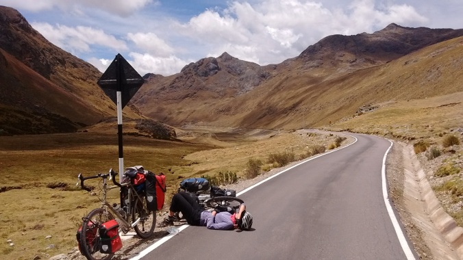
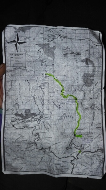
Take a picture of this map at the entrance as you won’t get another chance!

Choquiquerao ruins

  • 45 minutes from campsite. Two ways to go to main site. From top of steps immediately before/at campsite entrance, turn right for ‘main’ entrance via terraces and via turnoff to Yanama, was a shorter route. Turn left for entrance via truncated hilltop. Also a signposted route below the campsite to Paqchayoc.
  • Camping no longer allowed within the actual ruins, and nothing on sale at all, no bathrooms and no water source.  Take water with you from campsite.
  • Recommended to allow a full, long day to see all ruins including terraces below campsite

14764923351431.jpg

Pincha Unuyoc ruins

  • 2 hours from Choque campsite, 1 hour up to Abra Choquiquerao, 1 hour down.  To get on to trail, turn right at junction just before terrace entrance, to the Choqcue ruins, following a clear signpost to Yanama.  This is indicated on the hand drawn map that the guard shows you when you pay entrance fees.
  • Pincha Unuyoc has a few individual areas to wild camp, mostly in 15 minutes before ruins, but no organised campsite.  Water only available inside the ruins from irrigation channels that run through the centre.   Ruins infested with sandflies
  • Visitingruins/camping free, nowhere to buy supplies.

Maizal

  • 4.5 hours from Pincha Unuyoc, steep descent to riverbed and steep ascent.  15 mins before campsite, follow blue sign turning left for campsite (Valentin), where there was a tree branch blocking the other way.
  • Terraced site, lots of animals roaming free!
  • Basic supplies (rice, pasta, tuna, soft drinks etc.). We also managed to buy bread from campsite owner though probably not always available.  Offered to cook us lunch/dinner (for a price)
  • Cold shower for 3 soles and squat toilet for 1 sole, running cold water tap free to use


Yanama

  • 6 hours from Maizal, c1500m up to pass and down to valley floor.
  • Pass has spectacular views of snowy peaks, advised to get there as early as possible for best chance of clear views. Pass by mines on route up, can enter Victoria mine but was very dirty. Shelter at the pass with a small kiosk that was closed when we were there. Could possibly camp here in emergency
  • Yanama had a couple of large campsites. Very well stocked and cheap tiendas including fruit, veg, bread.. Also possible to buy gasoline from family in building to left of first campsite (ask around if unsure). We bought a cooked lunch from main campsite for 10 soles.  Recommend stocking up here.
  • Campsite had free squat toilet, cold shower and running water
  • Public telephone but not working when we were there
  • Apparently collectivos run from here to Totora and on to Santa Teresa but clearly irregular and we didn’t see any. More possible is to flag a lift with any trucks, we saw one such opportunity. Otherwise no traffic on road all day between here and Totora


Totora

  • 4.5 hours to Abra Yanama), 3 hours down to Totora
  • Follow path beginning immediately above main campsite rather than the paved road, Almost always shortcuts on path cutting across switchbacks in the main road, this saves a lot of time. Same on the way down but poor visibility meant we followed road a bit more.
  • Wild camping spots plentiful halfway between Yanama and pass when the valley opens up
  • Hornopampa 30 mins before Totora is first place to buy very basic supplies. Didn’t see any campsites
  • Totora had campsites with all facilities and fairly well stocked tiendas including fruit and veg. Didn’t try to buy fuel but no conventional petrol station
  • Not as nice as Yanama, glad we didn’t stay there, a little more traffic on road from Totora onwards


Ccolpapampa

  • 1.5 hours from Totora
  • We missed the trail and walked on the road which was higher up the valley and probably longer due to long switchbacks at end. Recommend to ask in Tatora for directions to walking path, but road was good surface and very easy to follow.
  • At t junction just outside Ccolpapampa, route joins Salkantay trek. Left to Machu Picchu, right then across river to beginning of Salkantay trek. To the right and across river is large area with buildings where groups on Salkantay seem to stay, presumably has all facilities, shops, alcohol etc.
  • Ccolpapampa is hamlet at bottom.  More basic supplies and more expensive than Totora and Yanama, but still everything you would need. Did have good range of fruit but bread was very stale. More focus on soft drinks and alcohol
  • Campsites had cold water, showers, western and squat toilet. Hot shower for 10 soles
  • Cafe which offered to do meals.  Could rent bicycles to cycle to Playa for 20 USD (they take your bags)


La Playa

  • 3.5 hours from Ccolpapampa
  • Passed a few small campsites/snack shops en route to La Playa, geared towards Salkantay groups. Main road goes on right hand side of valley but turn left and cross small bridge before main bridge to go onto walking path on left side of valley. Path undulates but mostly gradual downhill
  • La Playa has lots of tiendas selling all basic supplies, but more expensive than Yanama. Several campsites at far end of village.. Didn’t check facilities but assume has everything.  Also hospedaje at far end of village, (didn’t check price)


Lucmabamba

  • 30 minutes from Playa
  • Had lovely looking campsite (toilets, small tienda) with cafe selling proper coffee and meals. This and a number of places in following 30 minutes sold coffee and nice honey (small jar 10 soles)


Llactapata

  • Just over 2 hours from Lucmabamba, steep uphill then just over pass
  • Interesting looking ruins and great view to Machu Picchu, try to stay here
  • One campsite with restaurant and very basic snack and alcohol shop (didn’t sell any supplies needed for meals). . Noone there when we arrived e.g. for cooking food, so suggest arriving with supplies to cook for yourself.
  • 8 soles to camp, 10 soles for hot shower, unclear if cold shower is free (same cubicle as hot shower, we managed to use it for free but when no one around)


Aguas Calientes

  • 1.5 hours down to Hidroelectrica station which had lots of small tiendas, restaurants and one hospedaje that was closed when we were there.
  • 2.5 hours along railtrack to Aguas Calientes. Two campsites, one 30 minutes and one (municipal) 15 minutes before AC. First one had beach on river with a couple of spots, but mostly pre erected tents. Municipal campground looked better. 15 soles per tent and 30 soles for preerected tent at first place. Also had snack/booze shop, cold showers, toilets and running water.
  • Dozens of Hostals etc. In Aguas Calientes and restaurants, cafes etc. Try 4×1 pisco sours!


Machu Picchu

  • Must buy tickets in advance in Aguas Calientes, was an official ticket office off northeast cornere of square. Tickets to MP and MP plus MP mountain (only 7am slot) available, MP plus WP and MP plus MP mountain (9am slot) sold out.
  • Cross bridge near municipal campground, which opens at 5am and follow trail up. Took us 40 minutes but 1 hour more reasonable. Many people doing this walk
  • We arrived at 6.30 and large queue, but didn’t feel too full inside at this time after getting past bottleneck just past entrance
  • Coffee shop (around 10 soles for americano) with snacks, and very expensive buffet restaurant
  • Lots of people taking bags of all sizes in (including us) but apparently officially over 20l not allowed and no bottles or food allowed.  We managed to take in food and drink no problem.


Transport back

  • Walked back down tracks same afternoon as MP, lots of people at Hidroelectrica in mid afternoon hawking for collectivos back to Cusco direct (could get out at Santa Terasa/Santa Maria if wanted). Cost 40 soles pp, 6.5 hours for trip to Cusco.

Tips

  • Bring plenty of bug spray!
  • Trail to Choque in particular is steep and sandy in places. I managed in trainers, but hiking shoes probably better
  • Water available at all the campsites so no need to carry too much, but take a water purification method
  • Dogs/animals at all campsites. Bring earplugs!
  • Take small notes to pay for campsites and supplies
  • Start the hike up to Machu Picchu at 5am to esnure best chance of beating the crowds.

Costs

We worked out that we spent less than 450 soles each on everything, including food, transport, camping, entrance tickets (but excluding a slightly boozy afternoon spent in Aguas Calientes!).  That was about £100 or $130 USD at the time (September 2016).  A rough breakdown below:

  • Bus to Cachora turn off – 30 soles each
  • Collectivo to Cachora – 10 soles each
  • Camping fees – 6 nights @ 5 soles, 1 @ 8 soles, 1 @ 15 soles
  • Food bought in Cusco (4 days initial supply) – 100 soles (pasta, porridge, tuna, cheese,boiled eggs, noodles,buscuits, chocoloate, avocado, tomatoes, bananas, ham, bread)
  • Remaining food and snacks bought on trek (4 day supply) – 130 soles
  • Cooked meals bought on trek – 20 soles each
  • Entrance to Choquequirao – 55 soles each
  • Entrance to Machu Picchu – 142 soles each
  • Transport back to Cusco – 40 soles each

The one where we accidentally walked to Machu Picchu

Rewinding back to September (is it really now November!??), our time in Cusco felt like we were actually on holiday, with blue skies and lazy days. Breakfasts were late and al fresco in the courtyard of our hostel, afternoons were spent plodding the beautiful cobbled streets gawking at the mash up of Inca and colonial architecture , dusks spent over shameless Starbucks coffees and skype calls, and evenings passed putting my newly regenerated liver to the test with happy hour pisco sours. Folks cycling through Peru (yep,it turns out we arent the only ones!) congregate at Hostal Estrellita when passing through town and it was rather lovely to spend a few days surrounded by bike parts, route chat, and people with similarly excessive appetites to ours. Speaking of appetites, we may have indulged just a little……


We abandoned the fried chicken shops and guiltily left the other more thrifty cyclists at the hostel cooking up their pasta dinners to treat ourselves to some good grub.  Highlights for us were incredible Ceviche at Olas Bravas, a date night at Morena, which felt like being out in London (custoer service! cocktials!), and Bistek Montado at San Pedro market. A pile of beef, chips, avocado, egg, sausage, salad, rice, and a dangerous introduction to fried chese as an acceptable source of protein.  Looks horrendous, tastes incredible.

Two days of indulgence turned into 3, then 4, but finally it was time to get our bodies moving again, this time on two feet rather than two wheels. Bikes stashed, rucksacks rented and 14764923305623.jpg
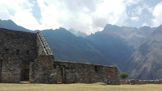
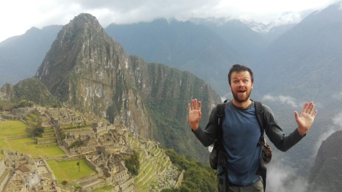
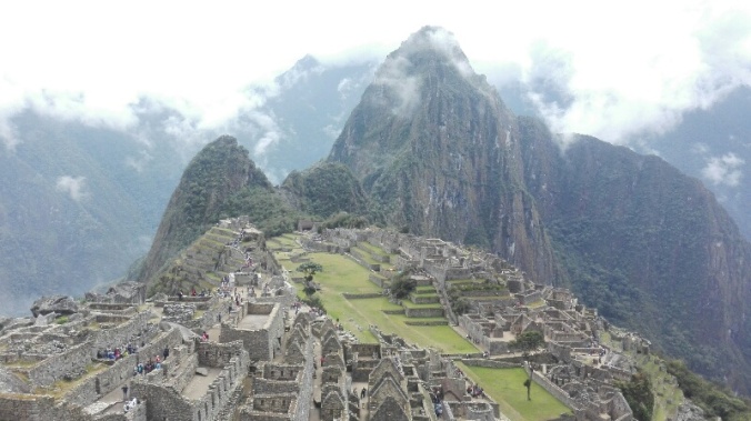
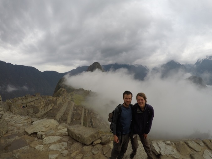
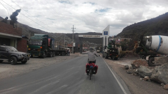
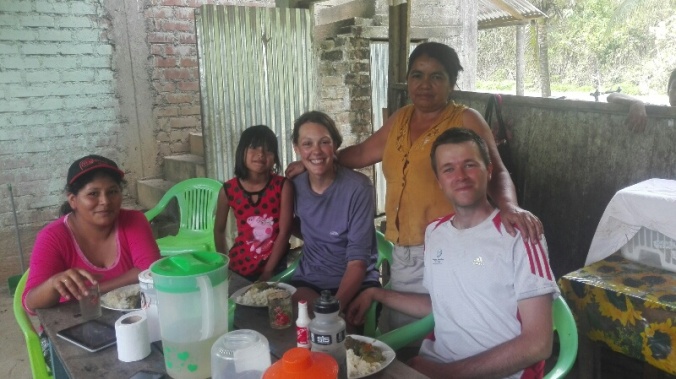
stuffed with supplies, we first had the hidden Inca city of Choquequirao in our sights, only accessible by a bus, collectivo then a two day hike in and one back from the town of Cachora.   Never ones to risk being left hungry, our bags resembled a mobile food market, with 35 bread rolls swinging from them, a kilo of pasta, boiled eggs, avocados, cheese, and an impressive array of buscuits, chocolate, coffee and bananas that would keep us powered for 4 days. Nevermind the fact that I’d only packed one pair of socks to make space for all these goodies. Priorities!

From Cachora we left roads behind, and slogged up one gorgeous, but bloody steep valley and down  the next, between basic campsites. The views were down lush hazy valleys covered in green with raging rivers running through them, and off to mountains on the horizon.  After so much stealth camping on the bikes where we pitch up late in hidden spots (often shared with cows/lamas/undescribable amounts of animal poo) it was a novelty to be able to pitch our tent in the afternoon sun and make a brew in peace.  Well, relative peace – we usually had a few thousand flesh-hungry sandflies and a barking dog or six to contend with  (this is Peru after all!).

We were feeling strong with our new legs of steel, and got a little carried away with all the walking. Our 3 day hike somehow turned into 9, and 125 kilometres and eight consequtive dinners of tuna, pasta and tomato sauce later we found ourselves looking at sunrise over Machu Picchu!

14764923305392.jpg

How did we end up here!??

We’d read that there was a trail linking the two hikes, but struggled to find reliable info about whether we would be able to do it without a guide, or be able to pick up food along the way. The tourist information (iPeru) office in Cusco was helpful, but their rep had taken a sharp intake of breath when we’d suggested setting out on our own, whilst tour agencies rubbed their hands together and quoted over a grand for to take us.   So instead we set off on our mini adventure to Choquequirao .  Which in itself, was amazing enough!

We reached the Choque ruins on day two, sprawling across a hillside of a huge valley, and thanks to being so cut off from road access, with very few visitors (we counted about 10 people when we were there!)  . The site’s only employee welcomed us with a hand drawn map of the complex, and we were allowed to camp there for free, clamber over the whole site the next day,  and pretend we were Indiana Jones.  Exhausted after a whole day spent exploring the and scaling the near vertical Llama terraces that miraculously cling to the steep hillsides (those Incas must have had thighs of steel!) we happily spent a second night at the campsite watching the sun set over the hills. Apparently there are plans afoot to make the ruins accessible by cable car in the next few years and make this the “next Maccu Piccu”, but looking out at the dense, unpopulated valley all around us, we have no idea how!


So how did we end up at Machu Piccchu? In the small village of Marampata before the ruins,  whilst scoffing an unexpected hot lunch cooked up for us by the owner of the campsite, we’d spotted a poster on a wall and some info describing the onward trail to Maccu Piccu.    We mustered our best Spanish to ask some of the locals about whether the trail was easy to follow, and got positive responses. Add this to the fact that the shrewd señora who had served us up our  had also set up a well stocked shop selling everything a hiker could need for a few days, and our minds were made up.  On to Machu Picchu!

14764923233588.jpg

Re-stocking in Marampata – everything you could possibly need to carry on walking (including a healthy supply of booze)

On we walked for 5 more days, eventually joining up with the Salkantay Trek which is a popular trek for groups of backpackers to the ruins, .  It was an AMAZING hike,  the perfect combination of isolation  (we saw only 5 other tourists),  a challenging but logistically easy walk, with one clear path to follow, and simple campsites with small shops at just the right distances.  The scenery constantly changed as well, and the second stretch was even better than the first.  One day we were we were building snowmen on the top of Yanama pass and the next we were walking through coffee plantations and picking oranges off treeson the valley floor. We loved it.

There were sweaty jungles, river crossings and huge butterflies….

Then snowy passes, valleys like the Scottish Highlands and our first peak at the snow capped Peruvian mountains…..

Always with a gorgeous place to camp, a cup of coffee, and a Sublime bar waiting for us at the end of the day…..

The final day was a walk along train tracks to Aguas Calientes, jumping off point for Maccu Picchu and a sudden throng of thousands of tourists, pizza restaurants and hotels.  We camped by the river just before town, and rewarded ourselves with a dip/shower in the Urabamba before heading in to town to indulge in a proper coffee and more than several celebratory “4 for 1” pisco sours.  .

After one too many snoozes on the 4am alarm thanks to my pounding pisco head and the equally pounding rain on our tent, eventually we did get up and at 5:30am raced up the 1500 that take you up to the ruins from the valley floor. Yes, there were crowds, there was a persistent drizzle, and there were far too many rules and over zealous security gaurds constantly repremanding us. But it was still Machu Picchu, and there is no doubting that it is pretty damn incredible……

14764923239361.jpg

6:30am, and my best picture that pretends we were the only people there!

DCIM100GOPROGOPR1456.

A rare photo that proves we are actually travelling together

DCIM100GOPROGOPR1450.

So we treked for 9 days and saw two of the most impressive Inca sites in Peru for under £100. We’ve even written up some notes to help others do the same- see How to hike independently to choquequira machu picch for under £100.